Choo Choo Coleman wrote:
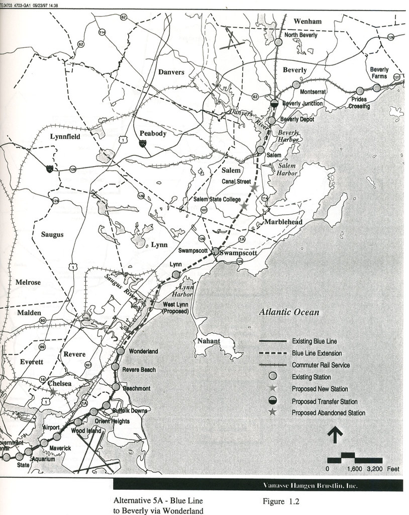
It's an interesting idea, but to go to Beverly would mean a tunnel under Salem which would be very expensive.
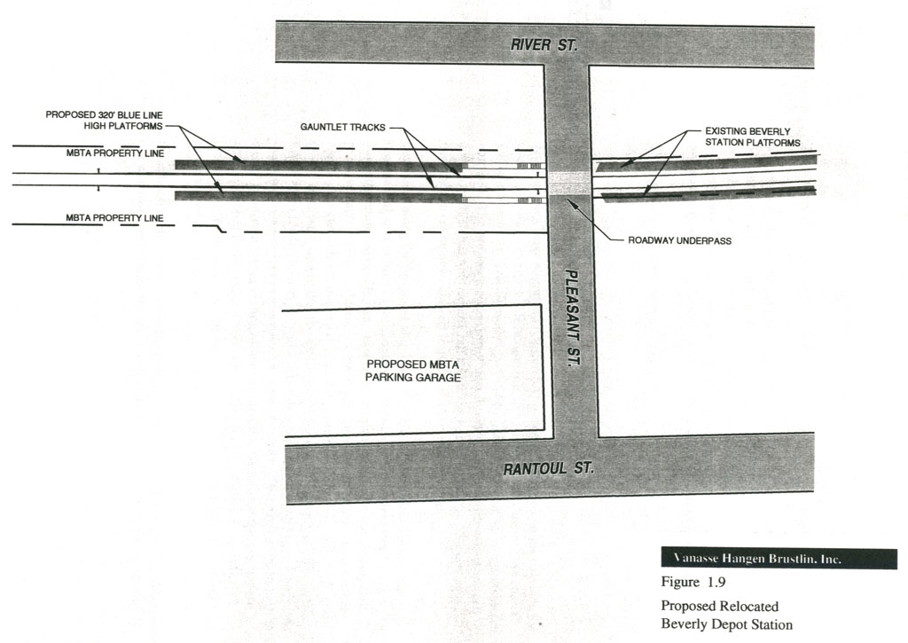
This would be addressed by ending the commuter rail at Beverly and having the existing tunnel used for the Blue Line.
Choo Choo Coleman wrote:
Also, I ride the Blue Line quite a bit, and during the morning and evening commute there is not much passenger room left even with the six car trains. If they took the Blue Line out to Beverly, the T would have to go back and expand the platforms to 8 car sets, which might be tough or impossible for the stations in downtown Boston. Or the T would have to order a whole bunch of new train sets.
This is why the study favored a split at Airport rather then continuing on through point of pines. The traffic coming off the extension would be on its own cars so the only time this would be an issue is from airport to downtown. The biggest problem they addressed is that the Wonderland branch would have its headways decreased 50%, from 3/5 min (peak/off peak) to 6/10.
In my own opinion I originally didn't like the idea of having the commuter rail terminate at Beverly. The study admits that while the morning rush would be easily handled by having the trains wait for the inbound commuter rail connection, outbound connections would be far more difficult. However thinking about it further, I would imagine the majority of commuters have to transfer to the subway at North Station anyway, and if they are going to the financial district it may actually be a positive to board an empty blue line train and get a seat versus cramming onto an already jam-packed orange line train or worse trolley. Other positives are that if a commuter is taking the B or D westbound they can also get an empty trolley at Government Center, versus have to transfer twice at NS.
IF this were to happen ever, I would think the best solution would be to have a fleet of Blue Line trains with forward facing seats (the flip kind) vs the current setup, making the transfer to subway more appealing to commuters on the now shortened Rockport and Newburyport lines. Having trains able to travel at speed (50MPH+) would also be essential to keep the trip times reasonable. (Anyone know if the new cars can do this?)
The other problem I can see is that Chelsea gets even worse transportation as they loose their stop, but perhaps a short Orange Line spur could be added (maybe even allowing the Oak Grove trains to actually use the express track!).