by REM3Night
Meadowbrook station was named for the Meadowbrook Country/golf club. It became Salisbury Park then Eisenhower Park.
Ray
Ray
Railroad Forums
Moderator: Liquidcamphor
LB wrote:Wasn't the Meadowbrook and Salisbury Plains stations two different locations? The Salisbury Plains station depot building stood for years near the Merrick & Stewart Avenue intersection (NW corner) and lasted at least into the 1990's.Remember the S. Berliner website? It's still on-line, and has images of what purports to be the Salisbury Plains station
LB wrote:Wasn't the Meadowbrook and Salisbury Plains stations two different locations? The Salisbury Plains station depot building stood for years near the Merrick & Stewart Avenue intersection (NW corner) and lasted at least into the 1990's.
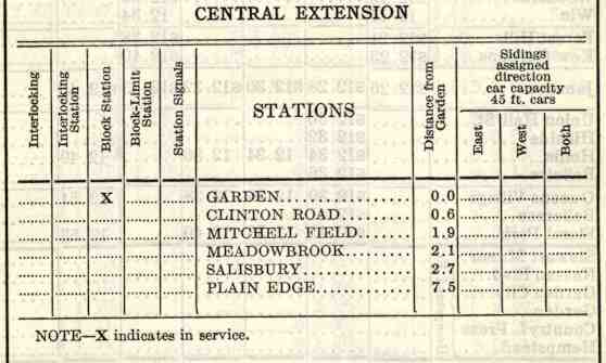
LB wrote:Interesting that Newsday wasn't listed as a stop. Was that freight only? Also, was Country Life Press the passenger stop for Newsday employees or was that Doubleday? That whole Salisbury/Eisenhower Park complex was the Salisbury Country Club; which during the depression was unable to keep up with the taxes. It was taken over by Nassau County and turned into Salisbury Park in 1944 (later Eisenhower Park in OCT 69, a few months after his death).Newdays would have been a reasonable walk from Clinton Rd stastion.
jack butler505 wrote:On a slightly related note, can anyone tell me where the LIRR Garden City freight yard is, or where it used to be? Somewhere near Stewart Ave by the MEadowbrook spur perhaps?Correct, SW corner of the intersection of Stewart Ave & Quentin Roosevelt (basically South St.) - now the LIRR Maintainance storage yard.
Sir Ray wrote:jack butler505 wrote:On a slightly related note, can anyone tell me where the LIRR Garden City freight yard is, or where it used to be? Somewhere near Stewart Ave by the MEadowbrook spur perhaps?Correct, SW corner of the intersection of Stewart Ave & Quentin Roosevelt (basically South St.) - now the LIRR Maintainance storage yard.
The "Meadowbrook" branch used to head north out of the yard across Stewart toward Zeckendorf, west side of South St. (by NRAD Medical center) - must be some old rail still visible in that verge, as that's what started this thread in the first place.
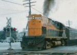
SwingMan wrote:Kind of sums up LI.
Pretty sad, Very little industry left...