by R3toNEC
Does anyone have a map that could be scanned, emiled, etc. which shows the Septa (prob Penn RR at the time) at its fullest extent...i.e R3 to WestChester, R5 to Lancaster, etc.
Railroad Forums
Moderator: AlexC
tinmad dog wrote:I have a picture of one of the old maps from the city hall concourse. It shows service to West Chester, Parkesburg, Pottsville, Newtown, and Ivy Ridge via Bala Cynwyd. Unfortunately I'm not sure how to get it on the website. The map in 69th street terminal is good to, but I don't have pictures. Also fun is at Market east, the signs on the westernmost end of the westbound platform still say R2 Marcus Hook, R3 West Chester, R6 Ivy RidgeDo you know how to go about getting one of those? I would love to get my hands on one. Also, is the item scannable? You could then post it, email it, etc.
tinmad dog wrote:I have a picture of one of the old maps from the city hall concourse. It shows service to West Chester, Parkesburg, Pottsville, Newtown, and Ivy Ridge via Bala Cynwyd.Is there one still around there? This is the one that shows the commuter rail lines in green.
jfrey40535 wrote:http://www.trainweb.org/railpix/miscpix ... 1-1976.jpgThat map is nice, I just wish it had all the stations on it.
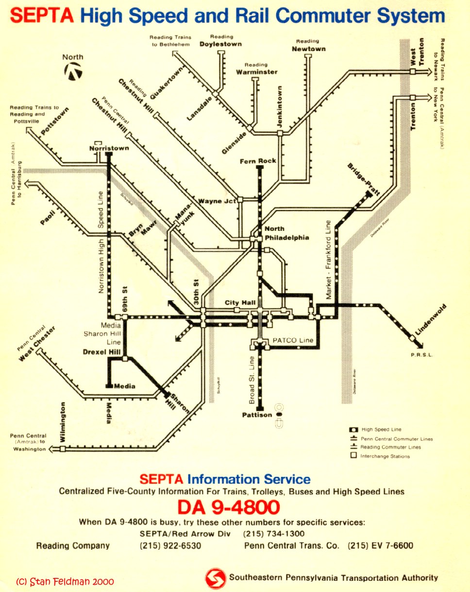
Here is the map you seek
Franklin Gowen wrote:There used to be one of the old, railroad-lines-in-green SEPTA maps at Exton. Might be gone by now. This one would be a better candidate for photography than the one I used to see daily at the inbound 15th St. subway-surface platform in 2002.That map is still there, and I've missed many a train because I was drooling over that map instead of running from the trolley platform to Suburban Station.
