Railroad Forums 

  • Wawa Extension

  • Discussion relating to Southeastern Pennsylvania Transportation Authority (Philadelphia Metro Area). Official web site can be found here: www.septa.com. Also including discussion related to the PATCO Speedline rapid transit operated by Delaware River Port Authority. Official web site can be found here: http://www.ridepatco.org/.
Discussion relating to Southeastern Pennsylvania Transportation Authority (Philadelphia Metro Area). Official web site can be found here: www.septa.com. Also including discussion related to the PATCO Speedline rapid transit operated by Delaware River Port Authority. Official web site can be found here: http://www.ridepatco.org/.

Moderator: AlexC

 #50708  by Lucius Kwok
 
Here is a map I made from USGS topo maps and some research I have so far:

Image

The project to restore rail service between Elwyn and Wawa includes about three miles of new track, catenary, signal systems, and structures including several bridges over streams and the Chester Creek. It also includes a new park-and-ride station at Wawa at Baltimore Pike (US Route 1).

Engineering work at the cost of $3 million has started. There is no date given for the completion of the project, but it may take five or more years to complete.

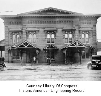
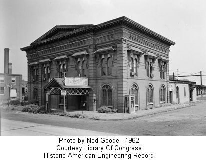
Passenger service between Media and West Chester was provided in the PRR days with a single car and passengers had to transfer to Philadelphia-bound MUs at Media. In the 1980s, lack of funds for track and bridge maintenance caused SEPTA to terminate the line at Elwyn. There have been plans to restore service but they were always shelved due to lack of funding.

The Delaware County Planning Department considers this project to be a high priority, and formally requested it to SEPTA in 1997. A feasibility study in 2000 reported that service to Wawa would add 700 daily passengers, provide 500 parking spaces at two new stations, cost $40 million to build and $1 million a year to run. Engineering was initially budgeted at $2 million to start in 2003, but now will cost $3 million and only started last month.

The Chester County Planning Commission places the extension to West Chester as a low priority for rail projects, citing the low density development and the proximity of R-5 rail service to West Chester. Passenger service along the Octoraro railroad is also given a low priority, but recommends that the right-of-way be preserved for future use.

Many people from West Chester feel that service should be restored to West Chester's Market Street station, but the problem has been getting funding to restore service. Currently, a tourist railroad, the West Chester RR, runs between Cheyney and West Chester. The single electrified track is still intact, but might not be in good enough condition for regular passenger service.

Because it is still early in the planning process, the costs and specifications may change. I have not been able to find out whether any of the intermediate stations (Williamson School, Glen Riddle, and Lenni) are being reactivated.
 #50740  by right-of-way
 
Nice map!

I figured that West Chester (City and University) wanted service. There is a spot where 202 passes over the line just south of the University...but yes given density and what not....it might be better to build a park and ride at Route 1. I could see that customers up the line (e.g. Cheyney and Glenn Mills) would drive there, out there that is just as far as the market just about. So I guess you just loose the Westtown and West Chester market but I guess they would just dirve 15 mins to the R5...how close is it by highway to Exton, Downingtown, etc?

There are two interesting operations on the line:

1) West Chester RR operates from Glenn Mills to West Chester somewhat reguarly with special theme trains as well.

2) Glenn Mills quarry has freight service provided by Amtrak or Septa engines...not sure who operates it and how often.

I guess the good part will be that it's getting done and modern signals, track capacity will be built. Now if they only could walk into the FTA's office and grab $150 million for the Route 100 extension to K of P and balance their books by not over capitalizing their bus fleet with all those half-empty articulated/talking buses they'd be onto something.

 #50753  by walt
 
As much as I would like to see rail service restored to West Chester, it is unfortunately the case that even in the PRR days, the portion of that line west of Media was simply very sparcely used. With regard to West Chester, itself, even though the then Red Arrow bus on WC Pike was slow and required a change at 69th Street to the MFSE, most people in West Chester who couldn't drive to meet what is now the R-5 used the bus, which ran far more frequently and for a greater part of the day, than the train. Add to this the fact that by the 1960's, the area around the Market Street Station had badly deteriorated, while the bus could be picked up anywhere along Market Street East of New Street and the old Short Line Terminal, and you have a situation in which the train was at a distinct disadvantage.

 #50774  by sccaflagger74
 
It's been at least 5 years since I've been in Westtown other than on 202 but given the growth out in that area would a park and ride lot on 926 be viable? I have a hunch that most of the housing boom out there is by workers from jobs on the 202 corridor so I don't know how much traffic it would get. Is there any space that could be used?

 #51020  by Lucius Kwok
 
The purple areas on the map indicate areas which were built up in the last 30 years or so, and there are still corn fields in the area which may one day become more subdivisions. The primary purpose of the extension is to add more park-and-ride capacity to the R3 Elwyn line.

West Chester: From there, once you get on 202, it's a five to ten minute drive to either the Exton or Malvern stations on the R5. I was just in WC yesterday and it feels more like a self-contained small town or a college town than a suburb of Philadelphia. They even have their own airport (Brandywine Airport, N99) to the north just off of 202, next to the QVC studios.

Most of the development is along the 202 and Route 30 corridors to the north, and the further south you go, the more farmland you see. Route 926 is just a two-lane road and most of the area near the train tracks is farmland. While there's a lot of open space for a new station on 926, access to the station is not too good unless the roads are widened.
 #51037  by Lucius Kwok
 
West Chester:

Image
Market Street. I saw many little shops and offices that look recently renovated.

Image
High Street. More offices.

Image
West Chester RR dining car, under catenary on the single-track in West Chester.

Image
A baggage car and three coaches. This area I'm standing in is a being turned into a small office park.

Image

Image
Market Street terminus of the West Chester line.

Lenni:

Image
Grade crossing at the Lenni station, looking east. There is a sign here that says it is a training facility.

Image
Looking west. Beyond the bend are some temporary buildings which I would guess to be part of the training facility.

Image
Looking east from station platform. The SEPTA map on the right is almost brand new, and still shows service to West Chester, Newtown, and Ivy Ridge on the PRR branch.

I did not get to the Wawa station because the access road is a narrow gravel road with a couple of old bridges, and there was no safe place to park on Baltimore Pike.

 #51068  by walt
 
Interesting photos, particularly of West Chester. My father grew up on Market Street one block from the station,and for a while in the early 1950's, his brother and family lived in a second story apartment right next to the station-- from the photos, it appears that that building has been torn down. The West Chester terminus once had a rather substantial station at that location, a far cry from the un-sheltered platform in the photo.

 #51083  by Lucius Kwok
 
As far as I could tell, there was no evidence that any substantial building stood near the train tracks at the West Chester terminus. I have a few other photos of the area but nothing particularly interesting. There's a strip mall to the east, and a couple old buildings to the west along Market St, but the area immediately adjacent to the tracks is a parking lot.

 #51101  by AlexC
 
Awesome map.
Is that put together from Topozone.com?

 #51113  by Sir Ray
 
I fear that picture of "Market Street terminus of the West Chester line" shows that westward expansion of the West Chester line is pretty much impossible. Did it ever go any further, or does anyone know if there were plans to do so at one point (late 1800s?)
 #51122  by Lucius Kwok
 
Thanks. I used Terraserver USA for downloading the maps, and of course the originals are from the USGS. Terraserver was a lot easier to use for downloading large maps than Topozone.

 #51205  by limejuice
 
Sir Ray wrote:I fear that picture of "Market Street terminus of the West Chester line" shows that westward expansion of the West Chester line is pretty much impossible. Did it ever go any further, or does anyone know if there were plans to do so at one point (late 1800s?)
This is a good question, and I hope someone out there could answer it because I've been wondering the same thing.
Image
If you travel along Gay St. directly north of the EOT, you will notice somewhat of an inclined "hump" which in my mind, seems to be remnants of a bridge above a former ROW. I'd only been through this area after dark, so I was unable to see more clearly, and I was unable to inspect the area further. I would tend to think that the original terminus would have been closer to the center of town, as the present Market Street location is closer to the edge. Perhaps, since the line was never a big revenue producer, the more valuable downtown real estate was sold for some quick cash, and the line was cut back to Market Street. I'm hoping that someone out there with actual knowledge could enlighten us.[/img][img]

 #51214  by Lucius Kwok
 
Image

This is the USGS topo map from 1984. You can see that the railroad continued north from West Chester. The most recent topo maps show the West Chester line as ending at Market St. The old railroad continued north towards Frazer, I think, where it joined what is now the R5.

 #51256  by walt
 
There once was an unelectrified branch ( I believe it was called the "Frazier" Branch which ran north from the West Chester Terminus of this line. I remember seeing tracks crossing Market Street just outside of the station. With regard to the station building, there is a web site which deals with present and former PRR stations which has a good photo of the West Chester Station building. It had largely fallen out of use by the 1950's, and was gone by the 1960's. The front of the building faced Market Street, with the loading platform at the rear of the station. The platforms were uncovered, even during the days when the station building existed, and you had to pass completely through the building to reach the platforms from the street.

 #51298  by limejuice
 
More intensive Googling turned up some answers. The station was on Market Street, at the location of the present terminus.

West Chester Railroad Station in 1930:
Image

In 1962:
Image

It was torn down in 1967 after having been neglected for years. A concise history of the line can be found here under the Railroads heading. Apparently, the northern abandoned portion of the line was the original line into town, and the line from Media came later. The station pictured above was built in the 30's after the Pennsy took over the line, and was likely on the Media side, so I would have to assume that there was once another station north of here.