Discussion of the past and present operations of the Long Island Rail Road.

Moderator: Liquidcamphor

  by Dave Keller
 
Found 2 scans I did have:

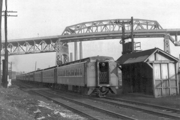
This shows the MU version of the light. When used as a motor, the light was the headlight. When used as the last car on the train, a red shield was slid in place, as shown in Dick Makse's great shot.
Image

And this is the type used on steam cars:
Image

Dave

  by badneighbor
 
details about RVC wreck... the phrase gauntlet would indicate two overlapping tracks in opposite directions? what was the story?[/img]

  by Dave Keller
 
Due to the lack of space during the grade elimination, a gauntlet temporary track (overlapping rails) was laid alongside the embankment for the elimination. In theory, it would be used by one train at one time, and was controlled by signals at the entry and exit points of the gauntlet track.

Something went wrong and an eastbound and a westbound train both wound up at the same point at the same time on the gauntlet track, shearing the lead car of one train completely in half the long ways, resulting in many deaths and injuries.

Dave

  by MACTRAXX
 
Dick and Dave - so THAT is what the 50s big red marker lights were! They were huge - I wonder do any exist in collections or at RMLI or other museums? Interesting stuff !! MACTRAXX

  by Long Island 7285
 
Any photos of the guantlet track at RVC during elimanation,

When Valley was elevated '32-33 did they actully re locate the row just south of the origional ROW> along the ROW there seems to be a trail with some waht of and embankment where the roads sinks under the elivated line. can this ROW be all that remains of the guantlet track, I have even seen and picked up small bits of coal both burnt and non burnt along there. is there any pics i can get a look at?

  by Dave Keller
 
First: The gauntlet track was at RVC, not Valley Stream. RVC = 1949-50
Valley Stream = 1932-33. Two different decades entirely. The wreck at RVC was February, 1950.

Second: I have no scans, but a nice shot of a double decker train ON the gauntlet track is in my sequel book.

Third: Valley Stream, as ALL the stations elevated, had shoo-fly tracks during the elimination process. The shoo-fly tracks at Valley Stream were, per general order #116-5C, (in ETT effective 6/19/32), located NORTH of the original track location effective 8/10/32. G.O. #116-7C (same ETT) moves the station facilities BACK south of the former location (location of 8/10/32) effective 8/31/32.

I doubt anything remains of the temporary shoo-fly roadbed after 73 years. It's possible that the remains of what you see at Valley Stream SOUTH of the main could very well be a siding that was removed some time ago, but since the elimination and you're seeing the remains of the grading and roadbed. (I'd have to check my maps and see if there were any sidings coming down to grade level AFTER the elimination.)

As an extra bit of history at Valley Stream: during the elimination, manned interlocking stations (cabins) "CA", "HO" and "HW" were placed in service on the Montauk branch and "GI" and "RO" on the beginning of the Far Rock branch! Must've been one busy place at the time!!!!!!

At RVC, "CENTRE" manned interlocking station (cabin) was placed in service 4/19/49.

Dave
  by Clem
 
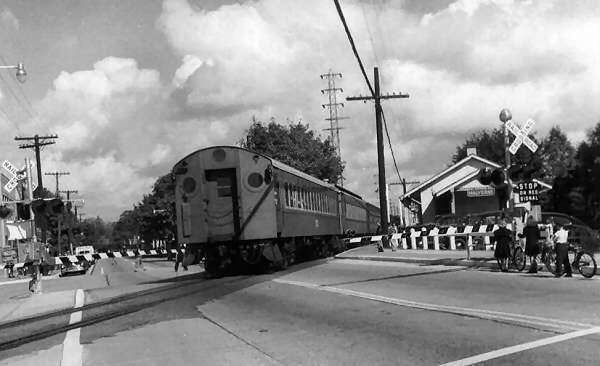
On the north side of Valley Stream was the trolley track which ran atop the Brooklyn City Waterworks culvert. The rise in the road north of the underpasses is to provide cover for the brick culvert.

Clem

  by Dave Keller
 
Hi Clem:

Thanks!

I thought he wanted to know about remains of a ROW south of the main.

Guess I misread his post.

Dave

  by Long Island 7285
 
So the water works cuvert runs directly north of the present tracks? and does it run pass the station or from the stream west.

also where the tracks are currently located since 1932/33 elevation, is that directly above the origional ROW or is the current structure built just north of the origional ROW. i will try to post shots of what im talking about.

Dave & Clem both you guys gave good replys.

  by Dave Keller
 
I believe the station facilities have shifted slightly west of the original depot at grade, if I'm not mistaken, however, the ROW should be in pretty much the same spot (relative to North/South) as the original tracks at grade.

Dave

  by Clem
 
Almost always, the centerline of the right-of-way remains the same. Temporary tracks are on the edge of the property of sometimes on leased adjacent property. Thats why somtimes you see garages knocked down or house corners trimmed back for the temporary tracks during a grade elimination program.

Stations move east or west often for several reasons: to minimize platforms on curves; to permit long platforms to serve two streets, or to provide for better use of parking and station plaza land.

Clem

  by Long Island 7285
 
Thanks Clem,

So mostlikely the "pipeline" as it's know in Valley Stream was used for the tempoary tracks during elevation?

And Pre Elevation did the rockaway branch leave the montauk/long beach branch west of the station where now it platforms first then leaves to both rockaway takeing the first switch, or stays streight to long beach.

  by Dave Keller
 
Pre-elevation, the Far Rock. branch left the main on the west side of Franklin Avenue. This was also the site of the Freight house. The depot was on the west side of Rockaway Ave. and additional access to the Far Rock. branch was made available by a spur curving off just east of Rockaway Ave. and heading SW. the station platform was in the shape of a sideways "V" opened to the west, with low platform alongside the Montauk branch and low platform alongside this curving east leg of the "wye." Additional low platforms (2) were located on the west leg of the wye ON the Far Rock branch itself.

The MU lay-up yard was between the old depot and the curve of the Far Rock. branch as the tracks crossed over Franklin Avenue.

The trolley tracks on the north side of the ROW ran down the center of Jamaica Avenue then crosed over the West Hempstead branch on an iron bridge. The line and the bridge were both removed in 1926.

The elevated station was located between Franklin Ave. and Hicks Street, so while the curve of the Far Rock. branch was practically in the same location as before, the station facilities had been relocated further west. The new team tracks were located at the site of the old station facilities on the west side of Rockawy Avenue.

Of course, the east leg of the wye accessing the Far Rock branch was never included in the elevation project.

Can you visualize all this?

Hope it answers your questions.

Dave