by nydepot
N 43.00484 W 78.67181 is National Gypsum Co.
N 43.00288 W 78.65182 is Universal Atlas Cement Co.
N 43.00288 W 78.65182 is Universal Atlas Cement Co.
Railroad Forums
Moderator: Otto Vondrak
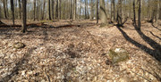
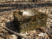
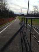
SST wrote: ↑Tue Apr 28, 2020 7:02 pm I also live about 3 miles away. I'll have to take a look. Is the abutment above the escarpment or below. parallel to the escarpment or perpendicular?It's above/at the top of the the escarpment. The abutment is between the trail and the edge. I don't know how to consider it parallel or perpendicularly placed, it just looks like it was a support to something that led off the escarpment. That place was really flat though, fallen trees, cut up logs..no large rocks except for the crumbled stuff where dirt's worn down to that beginning layer of rock at the top of the escarpment. The biggest "rock" there was this.
I've only walked it once a few years ago and I don't remember seeing it. Something to do.
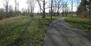
SST wrote: ↑Sun May 03, 2020 2:54 pm Well I walked it today but I didn't find the abutment. I searched in the area of your pin drop but found nothing. Where was this relative to the cabin?This is what I saw. I could see someone mowing their rear lawn, down below.
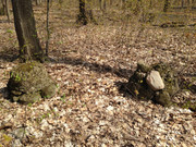
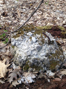
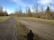
But I did find 5 very old concrete pedestals covered with moss but 3 with threaded metal rods coming out. I think they were just dumped here. I walked a straight line to the edge of the clif but see nothing in regards to the abutment. I'll post pictures later.