Railroad Forums 

  • Arch Bridge in South Lancaster, NH

  • Discussion relating to the pre-1983 B&M and MEC railroads. For current operations, please see the Pan Am Railways Forum.
Discussion relating to the pre-1983 B&M and MEC railroads. For current operations, please see the Pan Am Railways Forum.

Moderator: MEC407

 #1000370  by trainsinmaine
 
While we're on the subject of bridges way up Nawth: Several years ago, someone posted a message either in this forum or the New England Forum alluding to the existence of a large (as he described it) stone arch bridge that used to carry the B&M's Lancaster branch over a stream, about five or six miles south of town. The rail line has been gone for at least seventy years, but supposedly the bridge is still there. I have looked far and wide on the Internet for more fulsome information about it, but have never come up with anything.

Does anyone have a picture of this bridge, or know how accessible it is?
 #1000388  by toolmaker
 
I'm sure the conversation was in the New England forum and the bridge you're referring to was included somewhere within. I lived down the road in Littleton for 11 years. I tried to find the location where the old RR may have crossed the river without success. I was going on the assumption it crossed between Lancaster and the covered bridge in near Dalton, NH.
 #1000615  by ferroequinarchaeologist
 
I took photos of this bridge last summer - I have no idea where they are. IIRC, the bridge is over the John's River on the road leading west out of the center of Whitefield, so it may be in South Lancaster or Whitefield. It is clearly visible from the road although about 600 yards (long par 5) away. I'll keep looking, stop yelling.

PBM
 #1194384  by ferroequinarchaeologist
 
Well, I still haven't found the bridge, but I did find a picture of it on flickr - search Whitefield, stone arch, bog brook, and you'll find it. However, I did find another stone arch in the area:
Guildhall, VT
(201.6 KiB) Downloaded 6740 times
This is in Guildhall, VT, over a brook that emptied into the Connecticut River, just beyond the town center and the highway bridge from Northumberland, NH on VT Route 102, a few hundred yards south. The arch is bout twelve - to - fifteen feet clear of the water and about eight feet wide. This is on the abandoned Maine Central line from Coos Junction in Lancaster to Masons, NH, that crossed the Connecticut River twice. The line was built 1888 - 1890 and abandoned 1948.

PBM
 #1196300  by B&Mguy
 
It seems like there might be a little confusion in regards to two different stone arch bridges in the Lancaster-Whitefield area. Here's a description of one which I have visited and photographed, as well as a little information on a second one that is rumored to exist.

The first one is located about a half mile west of the old Whitefield B&M depot which is now a Dunkin Donuts. It is located on the old B&M White Mountains Division and was last used by the NHV in about 1997. The rails are still in place, and there are even some rusty freight cars parked on a siding. You have to pay attention as you're walking the right of way, as it is hard to tell when you are actually crossing the river. My friend and I were able to get down to the Bog Brook level on the north side of the right of way. The bridge has a center stone dated 1892, and is in fantastic shape. Here are two pictures of it that I shot that day:

http://www.flickr.com/photos/31011222@N ... itb-9Fx7Rw

http://www.flickr.com/photos/31011222@N ... itb-9Fx7Rw

The second bridge I have not actually visited, and have only heard rumors about. This one is supposedly located south of Lancaster on the originally B&M White Mountains Division which was abandoned in 1948. It looks like it might be the first river crossing beyond Coos Junction heading north after splitting away from the MEC Mountain Division. If you have a DeLorme NH Gazetteer, it's on page 47. If you look at coordinate F12, I believe it is under the word "New Hampshire" where you see a small waterway cross the dotted line of the old ROW. I could be wrong, but I believe this is supposed to be a large structure. It looks like it could be one private land, but I'm wondering if anyone has more information on this second structure, or whether it even exists at all?
 #1196321  by trainsinmaine
 
B&Mguy, I agree there's some confusion about this. The bridge to which you're alluding --- south of Lancaster on the old B&M roadbed --- was first mentioned in a post that was made by someone five or six years ago, in which (IIRC) it was described as "large --- and I DO mean LARGE" --- and visible from the highway, but apparently some distance into the woods, so easily missed in a casual drive. The location approximates what you've just described. So it is indeed there, apparently, but no one has posted a photo of it.

Thanks for these lovely pictures you've sent. This is an elegant piece of stonework, isn't it?
 #1196475  by Pat Fahey
 
Hi
I do not know if this would be of help, here is a B&M track chart showing the old route , this map does show where the B&M crossed steams and roads . South Lancaster was known as Mountorne, according to my book. Pat.
Lancaster , NH old route Dalton to Lancaster, NH
(143.62 KiB) Downloaded 6568 times
 #1529922  by NHV 669
 
I stumbled back upon this topic while cleaning up my RR related internet bookmarks over the weekend. I studied the notes between this thread, and the one in the NE Forum (Arches in New England). It appears that we've clearly located the arches at Bog Brook in Whitefield, and at an inlet to the Connecticut River in Guildhall. I looked at Google Maps and could trace the old RR bed quite well, from Whitefield up to Lancaster, and north towards Guildhall . The only time the RoW crossed the entire Connecticut between Whitefield and Guildhall, was north of Coos Junction, so we can rule out a Conn. river arch crossing in South Lancaster. I noticed only two other brooks/rivers that seemed to pass under the line. The first was just north of French Road, right after the sandpit, over an inlet to the Johns River. I walked out, and that one is a concrete culvert. Definitely a more modern piece.

Paul, I took your geo coordinates from the Arches in New England thread, and they put you right on the RoW in a marshy area north of where the line crosses Route 142 at the Dalton Transfer Station. https://www.google.com/maps/@44.4450266 ... a=!3m1!1e3

There is a structure there, but it looks more like a snowmobile bridge; the trail makes a noticeable S curve to get over the bridge, and it looks to me to be way too tight for a train to pass over. Street View from Route 135 shows us that the grass growing in the wetlands there is far too tall to see whatever is out there, but 600 yards sounds like a fair estimate. Definitely private land, I'll see if I can walk out there sometime soon to confirm what that structure is.
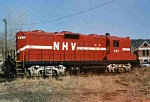
 #1543206  by NHV 669
 
I meant to hunt for the elusive arch at the end of spring, but never got around to it. I drove by the site above about a month ago, access is gated off.

However, thanks to a helpful tip, I was able to locate this one just east of Hazens over Bear Brook on the Mountain Division. I couldn't find a date anywhere on it.
Attachments:
Bear Brook
Bear Brook
20200518_191604.jpg (3.27 MiB) Viewed 2558 times
 #1543207  by toolmaker
 
That's in great shape. They don't build anything to last that long anymore.
 #1617263  by NHV 669
 
I finally made it out onto the former "Upper Coos" RR, and hiked all the way up to the GMaps coordinates listed above. No arch bridge anywhere, the RoW is washed out, and the trail and a bridge wrap around on the left side of the brook there.

I'm thinking maybe it's east of the Transfer Station?