Here's my posting from January 11th when it was announced (
https://www.facebook.com/groups/abandon ... RlIHRyYWls" onclick="window.open(this.href);return false;)
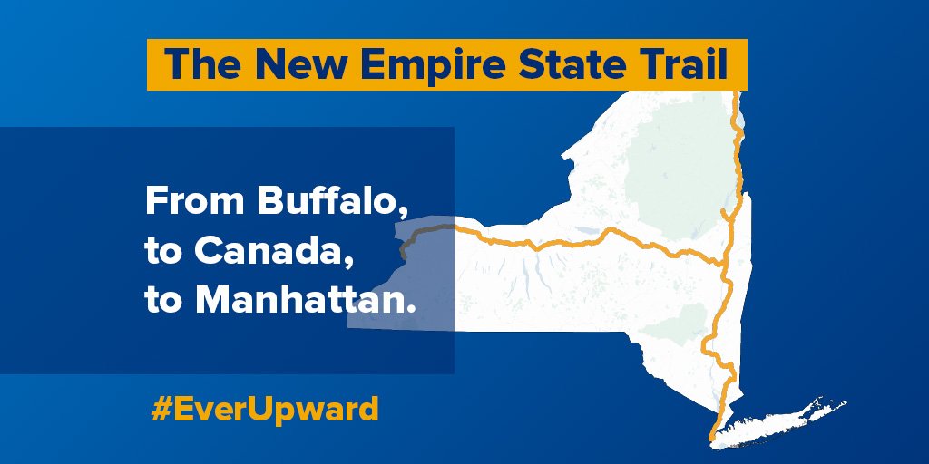
Today, Andrew Cuomo announced the Empire State Trail. It is to be a trail from lower Manhattan to Buffalo and to the Canadian border at Rouses Point. I'm wondering what the routing will be. Scant details are available. Cuomo claims that it will link 40 trails and "all be done on land we already own." This is the only map I've seen so far:
https://pbs.twimg.com/media/C10kC0oXUAAJp0r.jpg" onclick="window.open(this.href);return false; . Some of these are *definitely* abandoned railroads. Other parts can only be rail-with-trail.
Here's my speculation:
o Note that he said "link", not "use". Won't need 40 trails.
o The Hudson River Greenway -- runs along the west side of Manhattan.
o ? Have to jump from Inwood Hill Park to Van Cortlandt Park. 2 miles as the crow flies.
o The Putnam Branch, which is now a trail from Van Cortlandt Park to Brewster.
o The Beacon Line with a trail alongside? Or scrap the Beacon Line? Anyway, the map shows it used.
o The Dutchess County Rail Trail in its entirety.
o The Walkway Over the Hudson State Park
o The Hudson Valley Rail Trail
o ? Have to jump from Lloyd to New Paltz likely using the NY-299 right-of-way. 4.6 miles as the crow flies.
o Wallkill Valley Trail
o ? My guess is they cross to the east side of the Hudson at Kingston.
o ? I have NO CLUE how he expects to connect from Kingston to Albany. My only guess is rail-with-trail along the Amtrak / Metro North River Line. The trains go fast, but there aren't many of them once you get north of Poughkeepsie.
o Looks like they're going to cross the Hudson on the Castleton-on-Hudson bridge used by I-90.
o ? No idea how they'll get from Selkirk-ish to the Port of Albany, which is the southernmost end of the Canalway Trail.
o Once they're on the Canalway Trail, there are a few gaps that just need money and cooperation from CSX, which owns some critical bits of the abandoned West Shore.
o and then there's Syracuse which is a big podge of ick (as far as disused railbeds go -- they've all been built on).
o Back to Albany, you can head north on the Champlain Canal towpath or the Old Champlain Canal towpath, as needed. Some parts are a trail already.
o Mechanicville is another podge of ick, but much smaller than Syracuse. Halfway between it and Stillwater is the Stillwater Multi-Use Trail, the former Stillwater Branch.
o Back to the Old Champlain Canal Towpath.
o Schuylerville is actually fairly non-icky. There's a towpath trail up to Lock 5, then a closed road to cross the Hudson.
o Follow the Old Champlain Canal Towpath to Fort Edward.
o Old Champlain Canal Trail, with a connection to Lake George via the Feeder Canal Heritage Trail and Warren County Bikeway.
o ? I wildly wave my hands at Whitehall and mumble "rail with trail" to Canada.
