Chris,
it is a great book!
I just went and grabbed my copy to see what photo you were referring to..
(page 120)
yes, that stretch of LV is still in use.
its the line between Sayre & Ithaca..
still used by NS.
I dont know how much they relocated though!
or why..
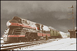
the photo in the book isnt dated, but based on the style of the locomotives I would guess 1890-1910.
here is the 1895 topo map..
doesnt show us much:
http://historical.maptech.com/getImage. ... g&state=NY
hey wait!
I found it!
open the 1895 map..
now open this modern map:
http://www.topozone.com/map.asp?z=18&n= ... ayer=DRG25
on the 1895 map, just south of the "D" in Danby, the tracks curve to the East around a hill, and they follow the stream.
on the modern map, the tracks go the WEST side of that hill, and away from the stream..
cool!
I wonder why they did that?
probably an easier grade, or maybe the stream was causing problems..
if you look really close, you can just make out thin traces of the old ROW on the NYS aerial site:
cant see the whole thing, but you can make out the divergence on the north side, and if you squint, you can almost convince yourself the whole thing is visable!
 http://www1.nysgis.state.ny.us/MainMap.cfm
might be worth a walk out there!
would be cool to try to find the exact location of the photo in the book.
that hill in the background is probably still about the same..
Scot