• The Old NYC Peanut Line.

  • Pertaining to all railroading subjects, past and present, in New York State.
Pertaining to all railroading subjects, past and present, in New York State.

Moderator: Otto Vondrak

  by BR&P
 
ScotCP356 wrote:FGLK run both Auburn and peanut line, but how much of track is peanut line?
It's been explained at least twice above. The ONLY part of the Peanut still active is from just west of the 332 crossing by Canandaigua City Hall to just west of Gibson Street.
  by ScotCP356
 
Oh, whoops, sorry maybe I should've read the post first. But I do have a question. What would the speed limit be on the old line?
  by BR&P
 
ScotCP356 wrote:What would the speed limit be on the old line?
If you mean now, under FGLK, on that segment, the last I knew it was 10mph max, yard limit rules apply. If you mean in NYC days, I don't have an ETT handy but my guess would be 10 mph in more recent times, maybe (again, guessing) 25mph back when things were in better shape.
  by charlie6017
 
In my copy of an NYC ETT from 1965 it reads:

Canandaigua & Holcomb, inclusive:

All trains....................20
Wrecking trains handled in wrecking service.........15
Bridge P-7, MP 6...............15

Charlie
Last edited by charlie6017 on Thu Mar 21, 2013 1:18 pm, edited 1 time in total.
  by ScotCP356
 
Oh interesting, thanks for the information.
  by lvrr325
 
scottychaos wrote:
Batavia map:

http://gold.mylargescale.com/Scottychao ... tavia.html

Scot
You're missing a dashed line for the wye that is clearly visible on sattelite photos where the new connector curves into the Peanut. It appears that for a time they also ran west of Batavia on this line from the Batavia yard.
  by Windseeker1
 
dj_paige wrote:I was wondering where the name Asparagus Junction came from. I didn't know that this area produced a lot of asparagus. Where were the tracks in relation to the station in this view?
Image
Ionia, NY by statPaige, on Flickr
I stopped by last night and took a quick look.
Based on the fact that there is a bay window on the backside of the structure and eyeballing the alignment of what is left of the right of way approaching the building, I am fairly confident is saying the tracks ran behind the building relative to your photo here.
  by FarmallBob
 
Windseeker1 wrote:
dj_paige wrote: Based on the fact that there is a bay window on the backside of the structure and eyeballing the alignment of what is left of the right of way approaching the building, I am fairly confident is saying the tracks ran behind the building relative to your photo here.
Looking at aerial photos and extrapolating from remaining grading visible to the east and west, it indeed appears the tracks ran behind (ie. along the the north side) of the station.

...FB
  by scottychaos
 
lvrr325 wrote:
scottychaos wrote:
Batavia map:

http://gold.mylargescale.com/Scottychao ... tavia.html

Scot
You're missing a dashed line for the wye that is clearly visible on sattelite photos where the new connector curves into the Peanut. It appears that for a time they also ran west of Batavia on this line from the Batavia yard.
Good catch! thanks...I never noticed that wye before!
I will get it added to the map..

Who first built the connector? (the loop of track connecting the peanut with the "new mainline" on the west side of Batavia)
The NYC mainline was re-routed south of Batavia in the late 1950's, so its possible it was built then..
and yes, since that segment of wye exists, it seems likely the Peanut must have extended west of Batavia for a time..
otherwise there would be no point to that wye..(although it could have just been used as a turning wye perhaps)
anyone know the timeline around these events?

thanks,
Scot
  by pumpers
 
Interesting factoid: what became the Peanut line opened in 1853 as the " Canandaigua and Niagara Falls Railroad". The Canandaigua and Elmira Railroad Company (from Horseheads/Elmira to Cananaigua) had already been running a year or two, connecting with the Erie RR on the south end. -- Because the Erie was broad gauge at the time, these other two RR's were too - so the Erie had a broad gauge connection all the way to Tonawanda. (The Erie originally only went to Dunkirk, NY, on Lake Erie, much further south/west than Buffalo, which it realized was a mistake, so it wanted a connection to the Buffalo/Niagara area.) So for a few years in the mid 1850's you probably could see Erie equipment in Canadaigua and on the future Peanut line all the way to Tonawanda! Too bad photography and the WWW hadn't been invented yet.

THis arrangment only lasted ~4-5 years, until the Canadaigua and Niagra Falls RR and the Canadaigua and ELmira RR both went into bankruptcy, and when they re-emerged the Canadaigua-NF line (under a new name) was leased to the NYC, changed to standard gauge, and nicknamed the Peanut line (1858?). You have to wonder if the NYC leased the Peanut line specifically to deprive the Erie of a route to Buffalo/Niagara ...
JS

Related, the Elmira-Canadaigua line (also with a new name) stayed moslty under Erie control until 1866, but then it was leased to the Northern Central (which in turn was later leased to the PRR).
Source: http://en.wikipedia.org/wiki/Elmira_and ... o_Railroad
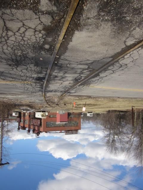
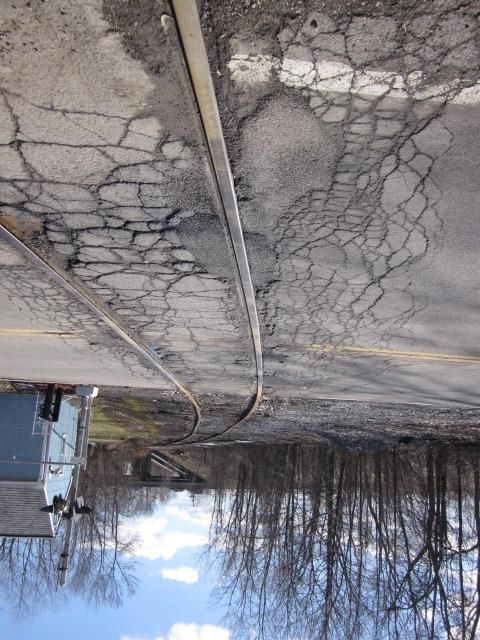
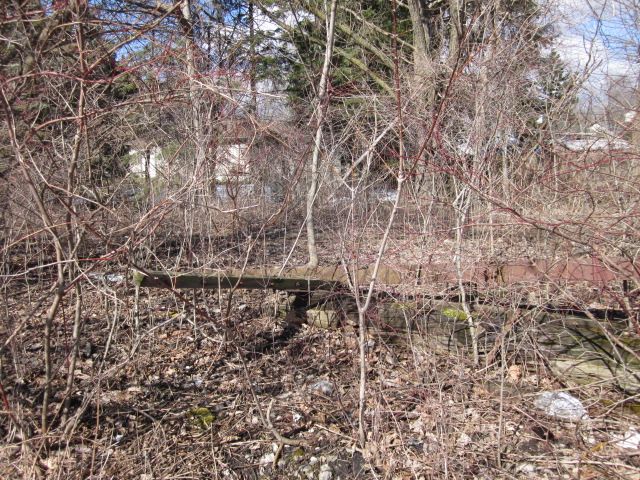
  by SST
 
JoeS wrote:On the west end, the Peanut Line terminated at the interlocking "Erie 3" which is on the old NYC Niagara Falls branch just south of the Tonawanda Creek/Barge Canal drawbridge.

There is a short remnant of trackage remaining between the interlocking and Wales Ave. in Tonawanda, however I think the Wales grade crossing is paved over.

This track was also used by the LV for trains on their Niagara Falls branch; traveling east from Wales Ave. the LV branched off the Peanut to the right at Tonawanda Jct. There is an unnamed road from Creekside Dr. to a water treatment plant, that passes right over the location where Tonawanda Jct. once stood.

From this point the Peanut ran east along the north edge of Ellicott Creek Park, crossed Niagara Falls Blvd. (south edge of St. Christopher parking lot) and was pretty much a straight track to near Akron Jct. where it crossed the West Shore.
I was shocked to read that the Peanut in Tonawanda at Wales might be paved over. If so, that means no more action on that section. I ride my bike up there but haven't crossed the line in a while. You can bet this has zoomed to the top of the list and I will check it out very soon. That stinks.

Over the years, I have managed to catch a random train on that section. SLOW! Like maybe 5mph. It is as bad as Ganson St use to be in Buffalo serving GM and ADM.

Before Clarence ripped up the row for the trail, I walked it. The ROW was severely overgrown and it was like a jungle in there. The RR ties were extremely rotted with large trees growing between them and in them. Heavy moss on the ties too. It's a nice trail with random telegraph poles still around.
  by TB Diamond
 
Reference the query above as to who constructed the connector from the new main line to the East Peanut west of Batavia:

The Batavia bypass was placed in service about 1957.

If anyone read my post above pertaining to the abandonment of East Peanut line segments then it can be ascertained that the E. Peanut between Batavia and Pembroke was abandoned in 1962. So, yes, the East Peanut did extend west from Batavia until 1962. The new connector where it crossed NY Route 33 and the remainder of the East Peanut out to Pembroke had been removed by 1964.

Considering this time frame, it must be assumed that the New York Central or contractors in the hire of the NYC constructed the connector.
  by RussNelson
 
lvrr325 wrote:
scottychaos wrote:
Batavia map:

http://gold.mylargescale.com/Scottychao ... tavia.html

Scot
You're missing a dashed line for the wye that is clearly visible on sattelite photos where the new connector curves into the Peanut. It appears that for a time they also ran west of Batavia on this line from the Batavia yard.
Here: http://www.openstreetmap.org/browse/way/52070643
  by SST
 
Still open for business and not paved over.

The first picture is looking back onto the property being served. The view is easterly with 3, probably 4 rail cars parked on the property. The rails on either side of the crossing show that this siding is quite active. There was no deep corrosion on the rails, just surface rust due to rain or snow.
Image

This picture is looking west. The Peanut ROW is to the left against the trees. The siding doesn't connect with the ROW until just before the bridge[Twin City Hwy].
I'd love to live in this house. It is so close to the track. You must feel the thumping as the train goes by.
Image

This pic is of a fallen telegraph pole and a sizable piece of rail either bent or purposely curved. Time stamp wasn't visible.
Image
  by JoeS
 
Nice pictures SST. I thought that the main was paved over but it looks like it is gone altogether and only the siding remains.

In the last years of Lehigh Valley that section of track was quite poor. The bent rail may be a remnant of a derailment in that area sometime in the early 70s. I hiked that section not too long after the wreck and it was apparent that maintenance had not been done in years.

Many ties had missing spikes and tie plates, and in a few spots the rail was reinforced by iron bars with hooks on the end to keep the rails from spreading.

I was thinking the other day that PC must have owned this track right up until Conrail, since it was originally NYC and the LV property started at Tonawanda Jct.