Discussion of the past and present operations of the Long Island Rail Road.

Moderator: Liquidcamphor

  by nyandw
 
Image

Photographer Edward Hand indicates East Setauket in 1988. However, I can't locate this snowed over grade crossing and the two sidings?
Anyone? :-)
  by freightguy
 
Setauket Materials? Long time LIRR costumer around MP 55 Sheep Pasture Road.
  by SwingMan
 
You are correct, freightguy. The switch and crossing are both long removed. The switch was removed in the time frame between this photo and 1991. The crossing lasted a little longer (Parsonage Road is the name). I myself am curious as to where that road led to based off of how things are today. Right behind the photographer is where the north/south power lines that cross the island fly over the railroad. It doesn't look like that crossing led to anything (a house, across to the west side of the power lines, etc.).
  by 4behind2
 
Also known in later years as Suffolk Mining.
  by cr9617
 
It looks like Consewogue Rd used to cross the tracks and continue on to Old Town Rd. I guess when it was split they renamed the western part Parsonage Rd.


Image

Image
  by nyandw
 
Well done, folks. Thank you for the maps and location. :-) I would have spent a lifetime NOT finding it.
Best


Setauket page: 
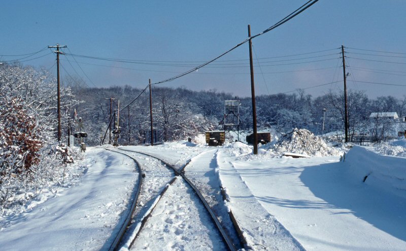
http://www.trainsarefun.com/lirr/setauket/setauket.htm

Then: Image
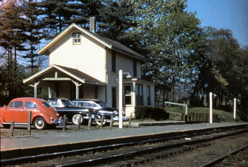
Setauket Station 1959 Photo: Art Huneke Archive: Dave Keller

And Now: Image
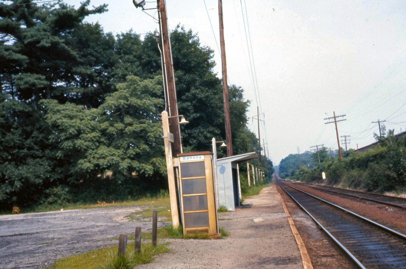
It's August, 12, 1973 and on this dreary summer's day we're looking east at the run-down Setauket station. The metal shelter shed replaced the old wooden depot when it was razed on October 3, 1960. Starting in the early 1960s as depot buildings were demolished, these ubiquitous metal shelter sheds were erected at some of the Nassau County station stops and at many of the Suffolk County station stops of the LIRR. Visible in front of the shelter shed is an also-run-down telephone booth. Remember them? Before cell phones, if you didn't have any change and had to make a call from a deserted station platform (like Setauket), you were sunk. Start walking! The platform and platform lamp posts are slowly being encroached upon by nature. This station stop would last until it was discontinued per General Order #207, effective September 6, 1980. Today you would be hard-pressed to even visualize a station stop ever being located there. (Dave Keller archive and data)
  by Teutobergerwald
 
There are two tracks in the photo showing the shelter. Is there / was there a siding at Setauket like at the other Port Jeff Branch stations east of Huntington, or was it just a team track for freight? Is there still a siding or team track at Setauket now? Thanks.
  by cr9617
 
There was a small siding there used for MOW equipment but that was removed about a year ago, maybe a little more.
  by SwingMan
 
Excellent map, CR. Thank you for that.

That siding in Setauket was double ended until the mid-2000s when the east switch was removed. Then when they put concrete ties in all the way out, they removed the rest of it. It's use was very limited if at all.