by ctclark1
I apologize if this is old news mentioned here already and I missed it...
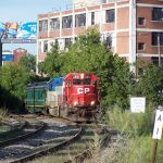
Ran across this while looking at switch alignments for updating the route overview for Wikipedia...
http://g.co/maps/j5yrs
Per Google Earth's historical view this was done late last summer/into fall (The image shown is 10/5/11 per Google Earth, the next oldest available image, 7/29/11, shows no indication of the future work to be done)
Was this to accommodate one of the businesses there wanting to expand out back? Some other reason like needing to improve the roadbed in the area without blocking freight runs? Or is this just a very oddly aligned run-around siding?