Railroad Forums 

  • Westville Cut-off

  • Pertaining to all railroading subjects, past and present, in New Jersey
Pertaining to all railroading subjects, past and present, in New Jersey

Moderator: David

 #510292  by Maggi
 
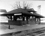
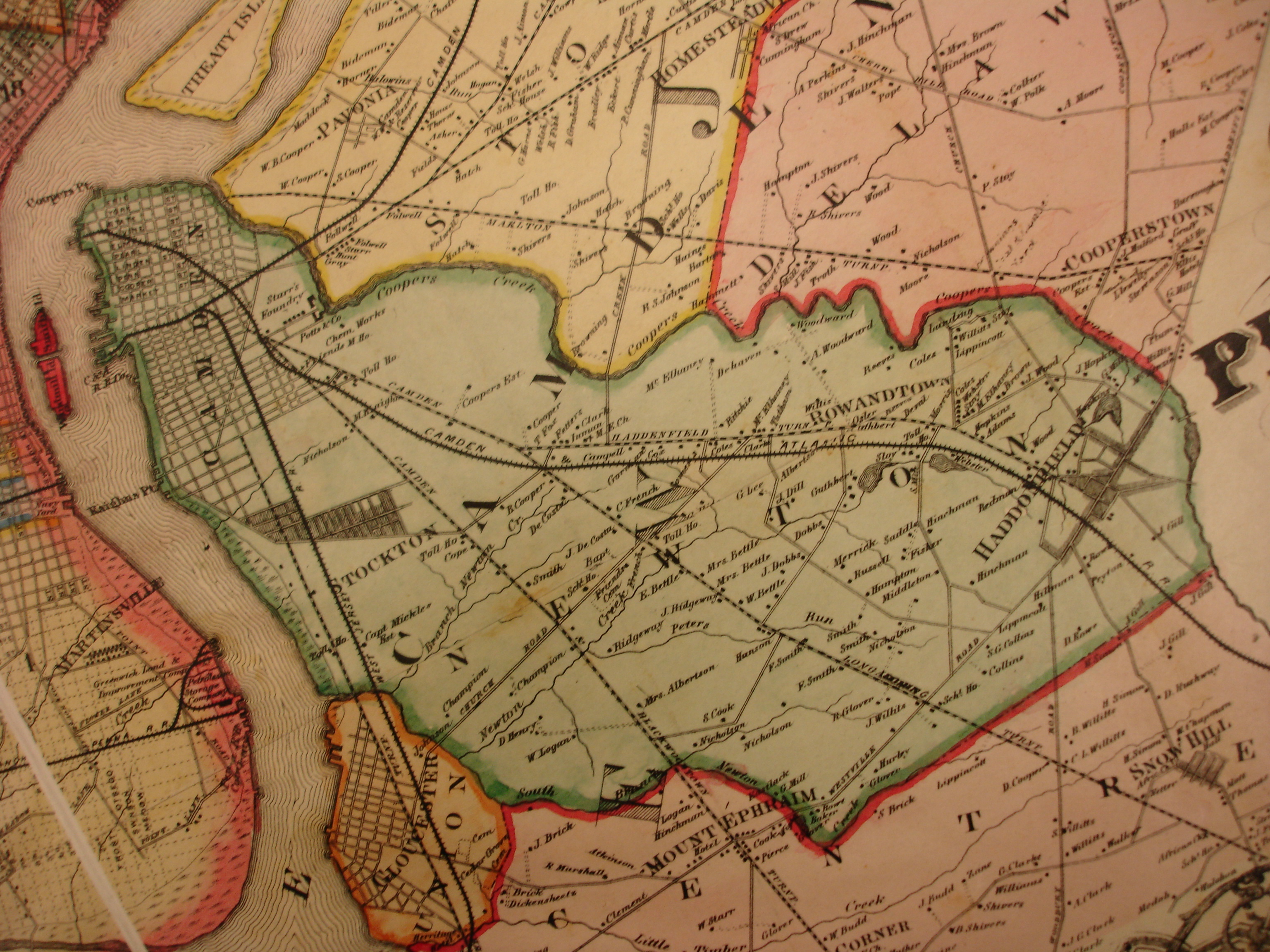
I am working with the Saddlers Woods Conservation Association to write a history of the woods which abut the Westville Cut in Westmont, New Jersey. The easement was bought by Merrick from Bodine (Millville Glass)to build the rail line and then sold to PSEG. After Merrick bought the land, and after it was excavated, parts of the creek were piped with old terra cotta pipes that still exist in the creek. What we are trying to locate are the orginal engineering plans from the railroad. PSEG is looking for them, but chances are slim. Would you happen to have any info on this?

Maggi from SWCA

 #510325  by David
 
Are you refering to the area between Pope Paul VI HS to the connection of the line in Haddonfield?--This area is referred to as "Haddon Township" with the Westmont area just slightly touched by the Cut-off at Haddon Avenue.
 #510332  by artifactsearch
 
Formerly lived in that area. Saddlers Woods is located between Paul VI H.S. and Crystal Lake Avenue. "Westmont' was used as a generic term for practically all of Haddon Township; except for 'Haddonleigh' (part of Haddon Twp. south of the gully), and the West Collingswood areas which remained as parts of Haddon Twp. when Collingswood Boro separated.

Jerry
 #510375  by Maggi
 
thanks for the quick response.

Saddler's Woods (see website www.saddlerswoods.org) is behind the Paul VI football bleachers and the Van Sciver Elementary school and continues along the stream line to MacArthur Boulevard. It is about 26 acres in size. The gully (the Westville Cut) is the edge of the woods closest to Graisbury Avenue. It is almost filled in now with phragmites, but you can still find some of the old train track pieces. I am researching the area from the gully to the headwaters of the stream. I can't determine where the stream begins because the gully construction may or may not have diverted the natural stream course.

Maggi
 #510480  by chuchubob
 
Maggi wrote: ... I am researching the area from the gully to the headwaters of the stream. I can't determine where the stream begins because the gully construction may or may not have diverted the natural stream course.

Maggi
When I lived in Westmont (until October 1950), a spring just off West End Ave in the woods was the beginning of a stream. I went there only a couple times, as I lived near the PRR (now NJT ACL) and played on and near it from the Maple Ave bridge to the trestle over Cooper Creek.
 #510579  by David
 
Maggi wrote:thanks for the quick response.

Saddler's Woods (see website www.saddlerswoods.org) is behind the Paul VI football bleachers and the Van Sciver Elementary school and continues along the stream line to MacArthur Boulevard. It is about 26 acres in size. The gully (the Westville Cut) is the edge of the woods closest to Graisbury Avenue. It is almost filled in now with phragmites, but you can still find some of the old train track pieces. I am researching the area from the gully to the headwaters of the stream. I can't determine where the stream begins because the gully construction may or may not have diverted the natural stream course.

Maggi
Are there tracks located behind Paul VI other then the tracks located in Audubon?
 #510688  by Maggi
 
Yes, there are remains of train tracks and part of a siding (wooden posts and boards) in the stream behind Paul VI.

Also, the stream off of West End Avenue is part of the stream that used to be Lake Euclid (where Elizabeth Haddon School is now located). This stream flows into Crystal Lake and then into Newton Lake. The stream in Saddler's Woods flows across MacArthur Blvd behind the Haddon Township High School and into Newton Lake.
see http://ancestortracks.com/PhiSur_Newton ... )_1868.jpg

you can contact me at
[email protected] directly if you have any maps of this area that can help us locate the original stream.

thanks, Maggi

 #510886  by georgehyland
 
It would be great to see some pictures of the track remains and other artifacts behind Paul VI. Would I be trespassing if I headed down there early some morning? My boys would love to do that. I will post my pictures from a couple weeks ago if anyone is interested.
 #510987  by artifactsearch
 
The information I have is that W.C. track was laid only from the junction in Brooklawn almost to Market Street in Gloucester. Any rails found near Paul VI H.S. may be the narrow gauge used during construction; but still a legitimate artifact. I plan to walk and photograph the entire route in the next couple of weeks; it's PSE$G property; just don't do anything foolish, such as climbing a pole for a "better view". Go ahead and post your photos; I'm interested.

Jerry

 #511025  by georgehyland
 
The tracks in the "gully" are indeed narrow gauge, which I have heard were for the excavation. It is pretty neat to see a switch down there. Please put up a post when you plan on exploring and perhaps a few of us can meet. I live a few blocks away near Paul VI.

 #511035  by David
 
Mike DiMunno and I have extensive pictures of the tracks in Audubon. The tracks are true narrow gauge tracks and are still in perfect gauge. As stated before, I have a map created by me from my memory circa 1955. Many of the artifacts from then are long gone. In 2005, Mike and I walked the entire line, except where the North South Freeway is located and the area behind Paul VI. to Crystal Lake Ave. Some of the elevated portions of the ROW are still located in West Collingswood Heights before reaching the Black Horse Pike. I will be in New Jersey for the month of June. I will look over this new information then. The only standard gauge tracks placed on the cut-off were from Brooklawn (area once called Westville) to Market Street in Gloucester City and used for a short period of time for storing refrigerated cars for Campbell Soup.
 #511220  by Maggi
 
You guys are awesome! Thanks for your help. Email me when you want to take a walk there and I will go with you. There are going to be tours on April 5 which is the 50th anniversary of Van Sciver Elementary School. Also, the New Jersey State archeologist has been there and found spear points along the banks. We used to think they were arrow heads, but the man said the NJ indians didn't use arrows, only spears.
There is also a pit filled with "railroad china" pieces and broken glass and silverware.

There is a two page story about the Westville Cut in the book "West Jersey Rails" by Wm. Coxey. I had a copy and lost it somewhere along the way. If anyone has a copy, they could scan it for me, and I would really appreciate it. I can't find a copy of the book anywhere.
Maggi[/i]
 #511359  by chuchubob
 
Maggi wrote: There is a two page story about the Westville Cut in the book "West Jersey Rails" by Wm. Coxey. I had a copy and lost it somewhere along the way. If anyone has a copy, they could scan it for me, and I would really appreciate it. I can't find a copy of the book anywhere.
Maggi[/i]
You can purchase another copy from West Jersey Chapter; click on "Books" in the menu on the left. Or come to the Chapter meeting March 24 and avoid the shipping charge, as well as mingling with some local South Jersey railfans.

Bob