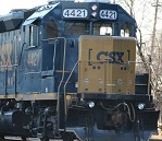
I was in Manchester today at the Shoprite on rt 70 They have started the gas pipe line in this area and it heading toward the Southern Railroad This is how it's listed on the historical surveys that have taken place over the last 6 years. I read through thousands of pages of gloppie goop and found things related the The Southern Secondary. While I can't say when they will reach the tracks or if they will do them at a differnt time this is just info. If nothing else this kind of shows that someone has plans for this section of the railroad in the future? No! A 40ft hole under the tracks isn't cheap to do if they weren't expecting trafic.
New Jersey Southern Railroad Historic District The New Jersey Southern Railroad Historic District is related to the “Transportation Routes and Railroads” resource group cited in the Pinelands cultural resource management plan (1991:194–205). On June 30, 2008, the New Jersey Southern Railroad
Historic District was determined eligible for listing in the NRHP and is significant for its role in the development of the New Jersey Pinelands, as well as for the railroad-associated buildings, structures, and objects that are extant along the line (Lynn Drobbin & Associates 2008: 184). The Pinelands cultural
resource management plan notes that the arrival of the railroads in 1850 may have been the event that had the most dramatic effect on the cultural map of the region.
The railroad tracks are part of the New Jersey Southern Railroad Historic District
The railroad consists of a single set of tracks on ballast that are elevated approximately 3
feet above the surrounding terrain. Historic maps and aerial photographs indicate that a track
scale was located approximately 50 feet south of the project corridor (Lynn Drobbin &
Associates 2008: . Remains of the track scale were not present in the project corridor.
In the early twentieth century, two sets of tracks were present across the project corridor (Lynn
Drobbin & Associates 2008:. A railroad turnout and siding providing service to JB
MDL is located approximately 200 feet north of the project corridor.
The New Jersey Southern Railroad Historic
District is located in the eastern part of the project and makes up the eastern boundary of the
Pinelands Commission jurisdiction. The project corridor crosses the linear district in Manchester Township,
just 300 feet northeast of the boundary of Lakehurst Borough. The railroad was constructed from 1856 to 1862, from the
Raritan Bay in Monmouth County to Atco in Camden County. The only elements related to the
New Jersey Southern Railroad Historic District that the pipeline alignment will cross are the rails
and ties. The report documenting the railroad does not indicate whether or not the rails and ties
are contributing or noncontributing to the district, but based on analysis of other track features in
the vicinity, it is likely that they are less than 50 years of age and therefore noncontributing. The
closest contributing resources to the pipeline corridor are a timber trestle bridge over
Manapaqua Brook built in 1946 (270 feet southwest), a communication kiosk built in 1929 (385
feet southwest), a signal bridge (400 feet southwest), and the NJ Route 70 Bridge over the New
Jersey Southern Railroad, built in 1938 (400 feet southwest).
The project corridor crosses the railroad approximately 400 feet north of the Route 70 Bridge, at the southeast corner of Lakehurst Borough.
The proposed pipe will be approximately 40 feet deep below the railroad tracks.