Are there any that were not completed but are just stubs.
"Acton Town S5"
Are there any that were not completed but are just stubs.
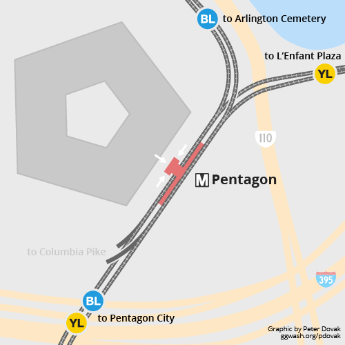
If you use the pure definition of the term, no. There is however a cut and cover equivalent at the south end of the Pentagon station for a future route along Columbia Pike.