by RussNelson
All of the New York State rail trails of which I am aware are available on one map here: http://rutlandtrail.org/gmap.cgi?allrailtrails
Railroad Forums
Moderator: railtrailbiker
scottychaos wrote:Great map Russ!Thanks!
1. you show a gap in the Greenway trail between the airport and Genesee Junction.Absolutely. That map is produced from my map of all railroads. I've found other difficulties with that format, so I've switched from my own data format to http://OpenStreetMap.org/ . It lets me mark railroads as rail-trails and also mark non-railroad segments as connecting paths. Plus I can connect switches, branches, and spurs so they're connected, and not just near each other.
I understand why the gap is there..its because the trail is not along the railroad bed for that stretch..
and that trail should also extend all the way up into downtown Rochester, to Court street, on the west side of the river.Yup to that also. If you look on OpenStreetMap, it should be there now. If it's not, you might want to add it in yourself. There's a bit of a learning curve to using the OSM tools, but you can make some nice maps. And then you can search them, so for example, I know that there are about 360 abandoned railroad bridges in New York State (30 of them in Rochester!!).
the Greenway follows the PRR into Genesee Valley Park, then a connecting trail follows the former Erie up into downtown,
but its all one continous trail today, just two different railroads..
2. What is the trail from Scottsville to Garbutt?Yeah, that was an artifact of how I had entered the GVG. As you say, it's not a trail at all. I've since fixed it on OSM.
the only railroad through there is the original BR&P..still in use by the Rochester & Southern railroad today.
Is this technically a "railtrail"? was this an old Gypsum mine spur off the PRR or something like that?
I am not familiar with this line..
CARMEL, N.Y. — Tim Burns, the owner of Village Bikes here, knows well the dangers of bicycling on busy roads. “I’ve lost three customers who died being hit by cars,” he said. “I don’t even try to sell road bikes anymore. People don’t drive a car anymore. They do everything except drive a car — texting, putting on makeup.”For myself, I haven't been on a bicycle since college. I'm afraid to, and when I was a teen, it "was square" to be seen riding one.
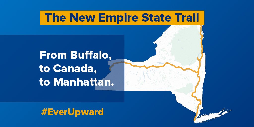
When Gov. Andrew M. Cuomo recently announced a plan to create the longest multiuse trail in the country, Mr. Burns and other outdoor enthusiasts cheered. His bike store sits next to the Putnam County Trailway, which will be incorporated into Mr. Cuomo’s plan for a 750-mile Empire State Trail. “It’s a great idea,” Mr. Burns said. “It is very safe and very well used.
RussNelson wrote:Further noteso The Beacon Line with a trail alongside? Or scrap the Beacon Line? Anyway, the map shows it used.
