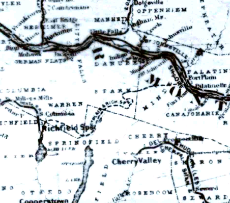
brakeman44 wrote: ↑Sun Apr 25, 2010 5:21 pmHowever, I could not figure out its route thru Hallsville and Starkville and Van Hornesville.
I have it partially correct in OpenStreetMap here:
https://www.openstreetmap.org/way/172946242 but not through Springfield Four Corners, which is the C&N.
It's quite clear going east of Van Hornesville on the LIDAR (
https://orthos.dhses.ny.gov/). South, I believe it follows NY-80.
https://orthos.dhses.ny.gov/?Extent=-83 ... =hillshade
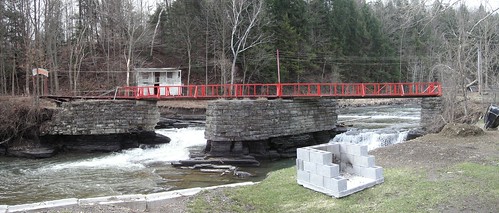
At Starkville it has to come down a big hill and so circles way out east and then back west before coming into Starkville. I think there was a trestle involved west of NY-80 there. Definitely a trestle east of Wagner Hill Road. Lots of erosion at Elwood Road.
Once past Starkville to Hallsville it goes through a lot of fields, but there are bits and pieces of the grade left, enough to let you know where it was.