Railroad Forums 

  • Maps showing growth and decline of American railroads?

  • General discussion about railroad operations, related facilities, maps, and other resources.
General discussion about railroad operations, related facilities, maps, and other resources.

Moderator: Robert Paniagua

 #1145954  by Benjamin Maggi
 
I am currently reading a book titled, "The Historical Atlas of North American Railroads" by John Westwood and Ian Wood. It contains dozens of maps and it arranged chronologically from the early beginnings to the modern era. I think it describes perfectly what you want- except that it isn't a free website.
 #1146286  by trainfan
 
RichCoffey wrote:
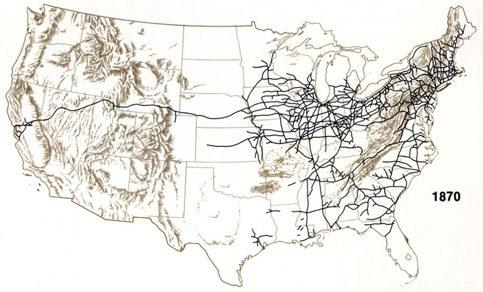
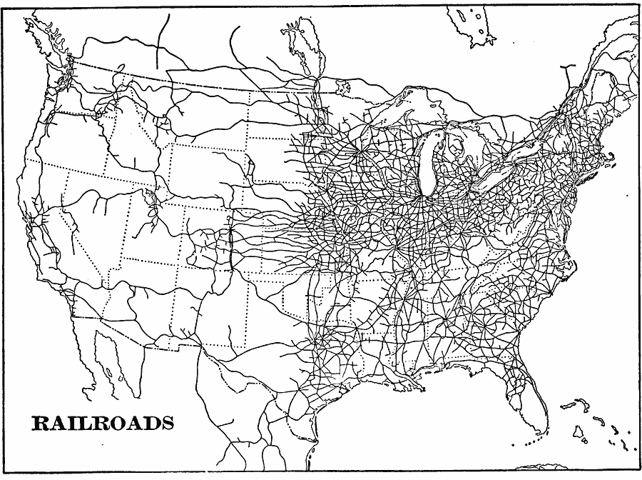
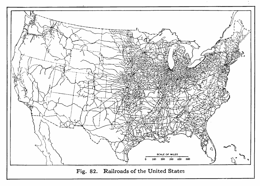
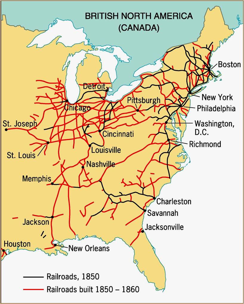
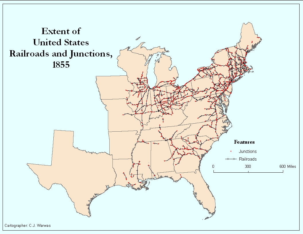
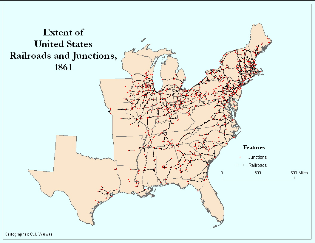
I am curious, is there a site that shows a series of maps of the USA displaying ALL the RR lines thru the years (perhaps by decade)?
Even better, a sequential animation dramatically illustrating the growth and decline...(?)
I'll second this that an animated map of the US showing the growth by decade of new lines, existing lines, and abandoned lines would be awesome and would help with a project I'm currently working on. Now that said, I haven't found anything like that yet. But it would be cool if someone here knows of something like that.
 #1146459  by RussNelson
 
I have a somewhat limited version of that goal. I have spent years getting the New York State railroads on http://openstreetmap.org into good shape. There is provision in the data for adding a start_date and end_date. My plan is to make an animation of the growth and decline of NY railroads once I have a start and end date for every line. Probably won't have that for another couple of years, though.
 #1148198  by RichCoffey
 
[ Russ Great stuff you are putting together - I look forward to seeing it coming to ruition ]

Re Maps showing growth and decline of American railroads?
Well I scoured more and came up with quite a few links but not a complete set anywhere to do the trick. I am looking for "10 year iterations of total US Railways. starting from the Baltimore and Ohio officially opening in 1830 to the present"

+++++++++++++++++++++++++
This was a good start (but only 4 decades...)
http://users.humboldt.edu/ogayle/Hist%2 ... RR1860.jpg
http://users.humboldt.edu/ogayle/Hist%2 ... RR1870.jpg
http://users.humboldt.edu/ogayle/Hist%2 ... RR1880.jpg
http://users.humboldt.edu/ogayle/Hist%2 ... RR1890.jpg

+++++++++++++++
Some scattered others...

1870
http://www.latinamericanstudies.org/19- ... s-1870.jpg
1901
http://etc.usf.edu/maps/pages/2500/2588/2588.gif
1916
http://etc.usf.edu/maps/pages/4400/4401/4401.gif
1920
http://www.extremeintellect.com/ei2009/ ... es/433.png

Simple but visually, very effective
http://msmcdushistory.pbworks.com/f/132 ... lroads.jpg

+++++++++++++++++
Another short series....
http://railroads.unl.edu/views/sources/ ... ansion.jpg
http://railroads.unl.edu/views/sources/US%201855.jpg
http://railroads.unl.edu/views/sources/US%201861.jpg

Others of Interest
http://www.landgrant.org/maps-us1.jpg
http://oldrailhistory.com/

BTW >> This Animation Is Cool!
Nebraska Railroads Expansion, 1865-86
http://railroads.unl.edu/views/item/bryan_rr_chars?p=1

Also for the modern day...
this is simple yet nicely done
http://www.ritholtz.com/blog/wp-content ... IL_MAP.gif

....and lastly
Interesting Concept but terrible load times and poor scripting bog this down WAY TOO Much
(Graphically pretty dull as well)
http://auroraproject.unl.edu/web/railroads.xhtml