Railroad Forums 

  • Help locating stations on LIRR (Suffolk)

  • Discussion of the past and present operations of the Long Island Rail Road.
Discussion of the past and present operations of the Long Island Rail Road.

Moderator: Liquidcamphor

 #1586332  by nydepot
 
I'm updating my site and have some stations I can't locate. Please provide lat/long or a link to google maps if they are still standing. Thank you.

Main Suffolk County page: http://ny.existingstations.com/w//index.php/Suffolk

Stations to be located:

Babylon - "Closed as of 2/2001. Slated to be torn down in 2001 after new station is built."
Calverton - 2nd station, 452 Montauk Highway http://ny.existingstations.com/w//images/d/d7/946.jpg
Central Islip - Suffolk Ave at Carleton http://ny.existingstations.com/w//images/c/ce/303.jpg
Eastport - Moved to Tuthill Ave http://ny.existingstations.com/w//images/c/cd/967.jpg
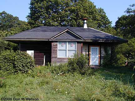
Old Montauk - http://ny.existingstations.com/w//images/7/7c/346.jpg
Pinelawn - Long Island Ave @ Wellwood http://ny.existingstations.com/w//images/6/6d/349.jpg
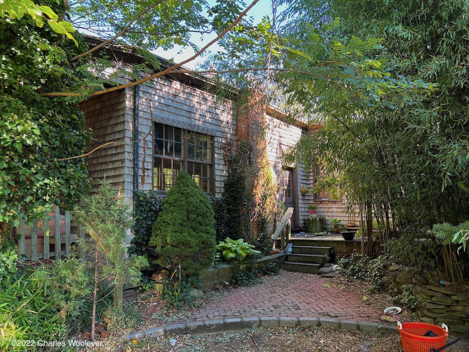
Rocky Point - King Rd at lumber company, lumber yard seems torn down http://ny.existingstations.com/w//images/d/d4/984.jpg
Shinnecock Hills - Depot Rd (east of Hills Station Rd) Is this really it? 40.88492,-72.45875 http://ny.existingstations.com/w//images/f/f7/985.jpg
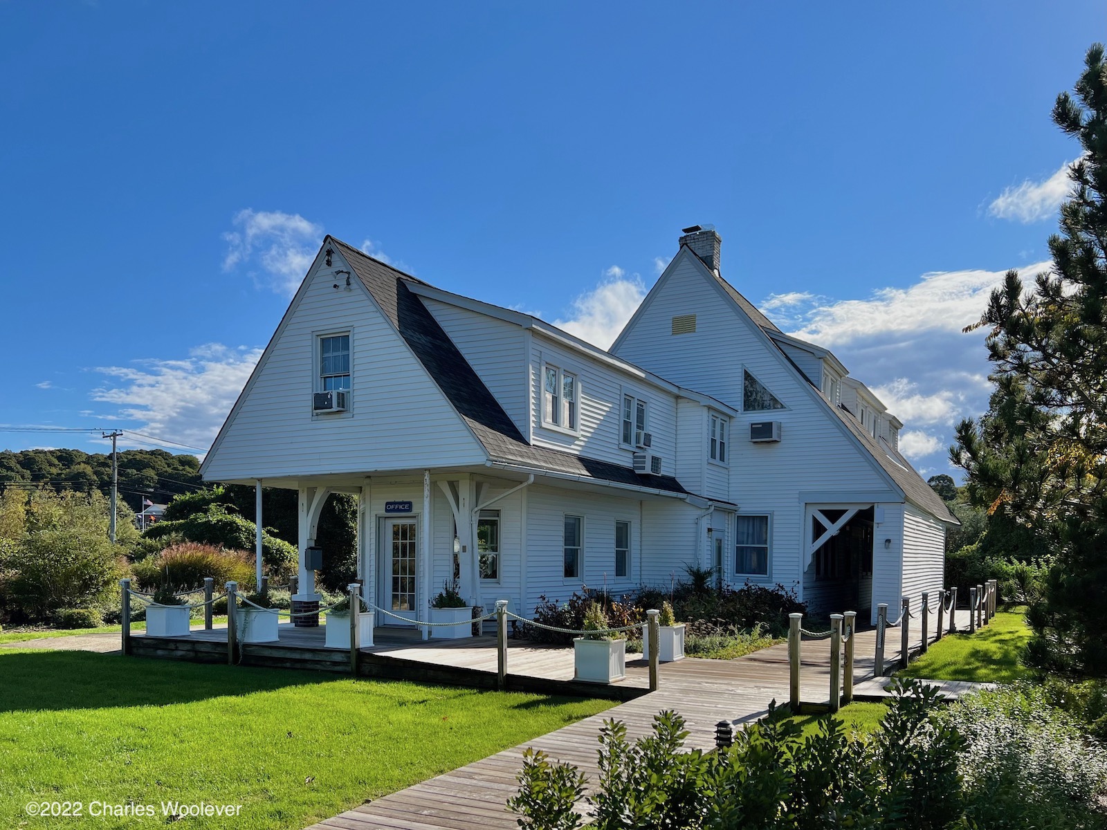
Southampton (Willow Lane) - Bad shape http://ny.existingstations.com/w//images/8/89/926.jpg
West Brentwood - south side of Pilgrim State Hospital http://ny.existingstations.com/w//images/6/6a/974.jpg
 #1586362  by krispy
 
Regarding Montauk - There was 4 stations, 3 now exist. The one shown in the link here: https://www.google.com/maps/@41.0491848 ... 8192?hl=en is the second station, moved by the Navy, was part of the ocean lab and finally the office building for the condos next door. Off to the left of the flagpole is the third one, given to an "Art" :wink: group in the early 2010's. During the busy seasons after the Montaukalypse, they did let the LIRR clerk have a portion of the building to cut tickets on Sunday, think it was 2016, 2017, but not sure if they continued after that. Last one is the island platform down in the yard, between the Main and 1 yard. There was also a freight house, that was moved not far away to the south on Industrial yard, either side of where 6 yard track is.

The one you refer to as "West Brentwood" was the actual station for Pilgrim, and they built that shelter like a tank. It's amazing at what good shape it's in now. Approx in this area, heck of a great spot for urban exploring, it's insane what used to be in this area. https://www.google.com/maps/place/40%C2 ... 73.2815051 Beware the ticks. See also this page from Arrt's website: https://www.arrts-arrchives.com/sthosp2.html

Not sure what you're referring to with the Babylon entry, Babylon has been unchanged since they elevated, and there's no plans (that I know of) to alter it in any fashion any time soon. Do you mean the pre-elevation era, instead of 2001?
 #1586375  by MACTRAXX
 
NYD: Interesting page on Suffolk County LIRR Stations. There does need to be updated status in some regard...
Babylon - the mention is when the renovation and reconstruction of the ticket office/waiting room under the
elevated structure occurred.
Central Islip - Closed when station was moved 1/2 mile east in Fall 1987 and then used by LIRR Police.
On same site is MTA Police District HQ for Suffolk County in a much larger building.
Pinelawn - Station building built by adjacent cemetery demolished during Farmingdale-Ronkonkoma
Second Track Project. There are now two platforms for both tracks platforming 2 cars each.
There are other stations on the list that I can add information about in subsequent posts...MACTRAXX
 #1586389  by nydepot
 
krispy,

I've added to my notes for eventual updates. Thank you.

So I should change West Brentwood to Pilgram for the station name?

Also, to be clear for all, my site involves the old classic station, not modern builds or platforms.

For Babylon, the photo I have shows this: http://ny.existingstations.com/w//images/2/25/873.jpg

When I go to it on Street View, the concrete and lettering is still there but "building" in that space is gone and there is just a standalone news hut:
Screen Shot 2021-12-08 at 8.11.21 AM.png
Screen Shot 2021-12-08 at 8.11.21 AM.png (4.41 MiB) Viewed 929 times
So whomever sent that blurb to me pre-2001 about tearing it down in 2001, did they tear the old building down and build a new one in a different part of the elevated platforms?
krispy wrote: Tue Dec 07, 2021 9:59 pm Regarding Montauk - There was 4 stations, 3 now exist. The one shown in the link here: https://www.google.com/maps/@41.0491848 ... 8192?hl=en is the second station, moved by the Navy, was part of the ocean lab and finally the office building for the condos next door. Off to the left of the flagpole is the third one, given to an "Art" :wink: group in the early 2010's. During the busy seasons after the Montaukalypse, they did let the LIRR clerk have a portion of the building to cut tickets on Sunday, think it was 2016, 2017, but not sure if they continued after that. Last one is the island platform down in the yard, between the Main and 1 yard. There was also a freight house, that was moved not far away to the south on Industrial yard, either side of where 6 yard track is.

The one you refer to as "West Brentwood" was the actual station for Pilgrim, and they built that shelter like a tank. It's amazing at what good shape it's in now. Approx in this area, heck of a great spot for urban exploring, it's insane what used to be in this area. https://www.google.com/maps/place/40%C2 ... 73.2815051 Beware the ticks. See also this page from Arrt's website: https://www.arrts-arrchives.com/sthosp2.html

Not sure what you're referring to with the Babylon entry, Babylon has been unchanged since they elevated, and there's no plans (that I know of) to alter it in any fashion any time soon. Do you mean the pre-elevation era, instead of 2001?
 #1586497  by nydepot
 
Are you saying Central Islip small station was torn down? I'm not seeing that little concrete hut at the new station or the old location in what is now the LIRR police building.
MACTRAXX wrote: Wed Dec 08, 2021 12:10 am NYD: Interesting page on Suffolk County LIRR Stations. There does need to be updated status in some regard...
Babylon - the mention is when the renovation and reconstruction of the ticket office/waiting room under the
elevated structure occurred.
Central Islip - Closed when station was moved 1/2 mile east in Fall 1987 and then used by LIRR Police.
On same site is MTA Police District HQ for Suffolk County in a much larger building.
Pinelawn - Station building built by adjacent cemetery demolished during Farmingdale-Ronkonkoma
Second Track Project. There are now two platforms for both tracks platforming 2 cars each.
There are other stations on the list that I can add information about in subsequent posts...MACTRAXX
 #1586893  by mkm4
 
nydepot wrote: Wed Dec 08, 2021 8:17 am So whomever sent that blurb to me pre-2001 about tearing it down in 2001, did they tear the old building down and build a new one in a different part of the elevated platforms?
See near the bottom of
https://derekstadler.wordpress.com/port ... d-station/
In the early-2000s, Babylon Station received an $8 million renovation...
It references an article but it doesn't seem to be online.
Carolyn James, “Work at Babylon LIRR Station to Start this Month,” Babylon Beacon, March 16, 2000.
 #1586898  by nydepot
 
Thanks for the article. The original station was removed.

"...new central building were to be completed during the first half of 2001 and the existing building, just west of the new central building, demolished."