Railroad Forums 

  • CT - Air Line Rail Trail

  • General discussion related to Rail Trails nationwide, including proposed rail trail routes. The official site of the Rails-To-Trails Conservancy can be found here: www.railstotrails.org.
General discussion related to Rail Trails nationwide, including proposed rail trail routes. The official site of the Rails-To-Trails Conservancy can be found here: www.railstotrails.org.

Moderator: railtrailbiker

 #244291  by RussNelson
 
That looks like a pretty keen trail.50 miles, partly through brush? That would be a GOOD day's ride.

 #250345  by crij
 
It is a nice ride, last I checked the area from East Hampton to Willimantic, is the better section (wide packed RoW, and Rebuilt bridges), north of Willimantic, is an amount of Mud Holes, but the section from Willimantic to Chaplin, recently got a grant to be cleaned, ditched and fixed. Should be nice to ride either later this year or next. Not to sure how the line is above Chaplin

Rich C.
Ct Eastern RR Museum
Willimantic, Ct 06226
www.cteastrrmuseum.org

 #250352  by RussNelson
 
I appreciate your concern, however, these are the kinds of trails I'm used to riding on:

Through the Bloomington Bog north of Saranac Lake, NY (beavers have flooded the trail):
Image

Rutland Trail east of Knapps Station:
Image

Mud doesn't scare me. It just gets me dirty. Broken glass, now THAT scares me. Oh, and so do rampaging cows as I ride on the railbed through their pasture.
 #1554303  by shadyjay
 
This spring, I got into rail-trail biking for the first time, and my #1 favorite trail thus far in CT has got to be the Air Line. I've ridden the Portland section and from East Hampton to Willimantic. This week, I've been working on the "Northern Section" which starts in Willimantic and continues out towards Thompson.

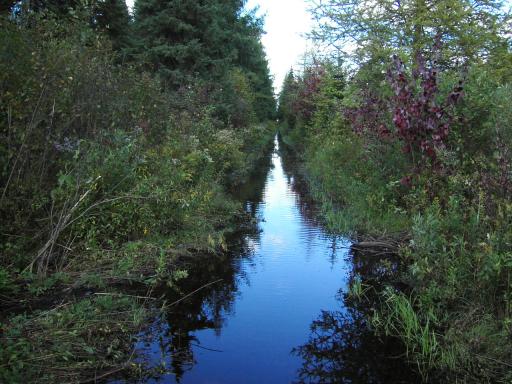
There is a section of a few thousand feet which is keeping the Portland and the East Hampton-Willimantic sections from being connected. The section in question has a stream running through the middle of it and is owned by Eversource (local utility, ex-CL&P/NU). The plan is to construct a boardwalk to get through the stream, so its not as simple as just clearing the trail and ditching. Some power poles have to be moved as well. Meanwhile, Portland is working to connect its section west towards the Connecticut River. I've seen the plans online and due to private ownership, the new trail will divert away from the existing ROW in many sections.

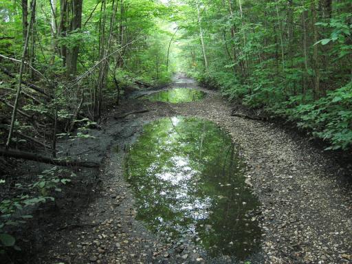
As for the section from Willimantic, eastward, yesterday I biked out to Hampton and back, which turned out to be 26 miles +/-. Surface was pretty good except for a section beneath US 6 that turns into single track and a little bumpy. I hope to complete the trail out to Pomfret on Friday and see how far it goes past Pomfret. I've heard some of it is impassable. [UPDATE 10/9 - I completed the trail to Pomfret "station" today, but east of there is under construction. New bridges/culverts being built, new surface, etc, so further exploration will wait for me until '21].

Meanwhile, here's my FLICKR Rail-Trail page to see the Air Line and all the other trails I've done this year thus far. I've hit trails in CT, NY, MA, VT, and RI.
https://www.flickr.com/photos/shadyjay/ ... 727127157/
 #1605913  by shadyjay
 
Yesterday (9/2/2022), I finally was able to clinch the Air Line Rail Trail in the state of Connecticut. Yesterday's sections concentrated in the northeast corner of the state, from Pomfret "station" to Putnam and then the Thompson section.

The Pomfret-to-Putnam section is the one that was under construction during my last visit (2020). While the new bridges and culverts are all in place and open, the trail surface leads much to be desired in most locations. Some sections all you can see of the trail is where tire tracks would be on a vehicle, with grass in the middle. Some sections (closer to the Pomfret end) were very stony (large stones). There were also lots of fallen trees. I was able to ride all the way to the washed-out Quinnebaug River bridge in Putnam. The new bridge is built much lower, so there is quite a bit of a steep incline to get between the rail-trail and the new bridge. Given the fact that from here to the Putnam/Thompson line, the right of way is obscured and not a trail, I drove to the other section.

The Thompson section had a much better surface. However, it suffers from some of the crossings on the Air Line further to the west suffer from: former overpasses or bridges were taken out, leading to very steep inclines to get from the trail down/up to the road, then back to the trail. One such is about 1/2 mile from the trailhead, crosses Route 193 without a crosswalk (however there apparently is a plan here to build a bridge). The surface was 10000% better than the Pomfret-Putnam section, except for a small couple hundred foot section of ballast which I pedaled right through. Scenery was nice too, the abundance of stone walls and "cattle underpasses" translates into a much different landscape some 120 years ago along this line. I biked to the state line, then hiked in to the tri-state marker, then back to Thompson to call it a day.