Railroad Forums 

  • "Peekskill Valley Railroad" 2-foot gauge - 1873

  • Pertaining to all railroading subjects, past and present, in New York State.
Pertaining to all railroading subjects, past and present, in New York State.

Moderator: Otto Vondrak

 #471745  by scottychaos
 
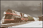
Anyone know anything about the Peekskill Valley Railroad??
I just read a little blurb about it in a book I have about the Maine 2-foot railroads..and in the beginning concerning early 2-foot gauge railroads it says:

"Certainly, prior to the construction of the B&B, there were lines built to such a narrow gauge but they were not looked upon as railroads in the accepted sense for they were little more than tramways. They carried no passengers, they made no reports, and each was the adjunct of some larger enterprise.

We cannot say that George Mansfield was responsible for the introduction of the 24-inch gauge railroad into this country but he was responsible for its ultimate acceptance.

The so-called Peekskill Valley Railroad in New York State was built in 1873 and was one of these commercial tramways. The Peekskill Iron Company built the line from their furnaces at Peekskill, Westchester County, New York, to a point on the Hudson River Railroad, seven miles away, with the idea that the trains of cars would roll by gravity down to the railroad and be hauled back by the little four-ton locomotive. It was a lightly constructed affair, but from the owner's point of view, it was a complete success."


From the book "The Maine Scenic Route, A History of the Sandy River & Rangeley Lakes Railroad" by H. Temple Crittenden, 1966.

anyone know anything more about this little Peekskill railroad?
I would love to find a photo of that locomotive!

thanks,
Scot

 #471865  by Mark_K
 
From what I know there is very little if anything remaining of the narrow gauge ROWs around Peekskill.

One of the lines ran from Annsville Creek through Peekskill Hollow north past Continental Village. The tracks lay abandoned for about 20 years before removal.


In Fahnestock State Park an old mine narrow gauge is now a trail. I don't believe it hooked up with any of the Peekskill operations.

 #471963  by enwhycentral
 
Here are three tidbits of info relating to the Peekskill area narrow gauge.

1. A short-lived narrow gauge line pushed up the Peekskill Hollow from Peekskill Creek.

2. Paul Forbes built a narrow gauge railroad from the Sunk Mine to a point on the Philipstown Turnpike.

3. During 1878-1880, high grade iron ore from the Croft or Indian Lake Mines was extracted and transported by narrow gauge railway down Canopus Valley to the Peekskill Blast Furnace at Annsville Creek. The mine was abandoned in 1887 and the tracks removed for salvage in 1910.

 #471999  by Otto Vondrak
 
Regarding the line at Fahnestock Park, I think that served the Denny Mine, and as such, I dont think it was common carrier, and it didn't connect to any other railroads.

Regarding the original post about the Peekskill Valley Railroad, I'm not sure. It may have been considered a private railroad serving a mine rather than a railroad as we think of it today- especially with the gravity function!

The iron ore industry in upper Westchester and Putnam Counties largely collapsed by the end of the 1890s as richer, easier to mine veins of ore were discovered in Minnesota.

One last ditch attempt at mining in Putnam County was at the colorfully-named Tilly Foster mine. It was once an underground mine that suffered a collapse. It was converted to a strip mining operation by another owner before finally giving up around the turn of the last century.

http://www.catskillarchive.com/rrextra/tillyfos.Html

-otto-

 #472028  by RussNelson
 
Kudish lists disconnected, trams, and underground railroads in Railroads of the Adirondacks. I'm following his lead on my New York Railroad Routes, so if anybody has any good idea of the routes of these mine railroads, I'd love to add them.

 #472224  by Mark_K
 
It's pretty clear there were at least 2 narrow gauges radiating out from Peekskill. One in Canopus Hollow (which Russ may have found remnants of on the aerial survey) and one in Peekskill Hollow.

The Sunk(en) mine railway was in what is now Fahnestock State Park.

 #472311  by Otto Vondrak
 
The mine railroad around Sunken Mine and Denny Mine can be found on older USGS topo maps (look around the area of Dennytown). Same for some of the older maps of the region.

-otto-

 #472348  by RussNelson
 
Would these mines be anywhere near Moneyhole Mountain? :-)

I looked at both the 1892 and 1943 maps from here:
http://docs.unh.edu/nhtopos/WestPoint.htm
and found nothing of interest. But, by studying the PCNR Hiking page, I found this:
http://rutlandtrail.org/gmap.cgi?sunken ... d.ny.track

Not sure where it goes west past Fahnestock Corners / Cold Spring Institute. It might not go beyond 301: http://nynjctbotany.org/lgtofc/nycanops.html

 #472369  by Otto Vondrak
 
If you're looking at the West Point quad, it would be in the NE section, around Dennytown. Guess it wasn't on the 1892 map, I'll look and see if I have any sources at home.

-otto-

 #472641  by Mark_K
 
The late transportation planner Gordon J. Thompson did a survey of a large number of obscure RR ROWs in the mid-Hudson Valley back in the mid-1970s. Many were fairly detailed, as in this example:

http://www.columbia.edu/~brennan/dunder ... ompson.JPG

He makes mention of the Peekskill operations in one of the monographs I saw 10 years ago, but I don't think there was much data for him to expand upon. I'll need to do some digging.

 #472645  by RussNelson
 
Mark! It's 3AM! You've got to get to bed!

Yes, that Dunderberg map is detailed enough to find the railbed on the 30cm per pixel NYS color ortho photos such as the ones Google Maps serves up.
http://rutlandtrail.org/gmap.cgi?dunder ... y.ny.track

So if you can find anything else by Thompson, that would be great. Even if there are only fragments visible on the ground, it's still worth listing them. The whole point is to enable people to find them, so if they're there, we should list 'em!

 #472702  by scottychaos
 
thanks for all the info everyone! :P

I would sure love to find a photo of that little 2-foot locomotive..
but I doubt one even exists.. :(
oh well..its still some interesting history!

thanks,
Scot

 #473327  by choess
 
The 1881 Bromley Atlas (available at http://www.davidrumsey.com/) shows on its Peekskill map the lower part of the Peekskill Valley Railroad, crossing Annsville Creek on a long trestle and running along the south bank to the ironworks and what looks like a little interchange with a NYC spur. The Cortlandt map shows the whole length of the line, albeit with little detail. The Beers Atlas of 1868, same location, shows the Peekskill Iron Company at the ironworks location, but no railroad, although that's not definitive evidence of its absence at the time. However, this atlas does show the line to Sunk Mine, which it refers to as the "West Point Railroad". (The Sunk Mine appears to have been referred to as the West Point Mine at the time.) According to the blurb on the back of my NYNJTC map, this railroad was built from the Sunk Mine to "Dump Hill", at NY 301 and Dennytown Road, where ore was transferred to horsedrawn wagons. In 1874, it was extended to the Canada Mine, lying about 3 miles NW up Sunk Brook.

The historian Allison Albee collected extensive notes on the mines lying on the east side of the mid-Hudson Valley, which repose both at the Westchester and Putnam County Historical Societies. (Otto?) Notebook XIII includes information on the mine railroads, particularly "the railroad from the Croft and Todd mines in Putnam Valley to the furnace at Annsville Creek in Peekskill and the Sunk and Canada mine railroads in Putnam Valley" (that is, the Putnam Valley and West Point Railroads), also the proposed railroad suspension bridge at Anthony's Nose.

Present-day pictures from the Croft Mine can be found at http://hometown.aol.com/oldclock50/Croft.html

 #473370  by RussNelson
 
Do you have a link to these maps? I cannot find them on davidrumsey.com.

I would much prefer that he simply post high resolution scans of maps, with georeferencing information if he has it. The insight browser just gets in my way. Either that, or serve up map tiles using a WMS server.