Railroad Forums 

  • Ashmont-Mattapan Trolley Line Discussion

  • Discussion relating to commuter rail, light rail, and subway operations of the MBTA.
Discussion relating to commuter rail, light rail, and subway operations of the MBTA.

Moderators: sery2831, CRail

 #1391860  by jonnhrr
 
The Mass DOT capital investment plan adds money for continuing the trolleys on the Mattapan Line, as well as money for the Blue Hill Ave station on the Fairmount commuter line.
From an article in the Dorchester Reporter:

http://www.dotnews.com/2016/state-budge ... t-spending
Another Mattapan project that has received significant support from local elected officials has found its place in the budget. The Mattapan High Speed trolley, which travels between Ashmont station and Mattapan, is approved for about $9 million in maintenance and improvement investments. Its existing Presidential Conference Cars (PCCs) are preferred as the line’s service vehicles by nine local officials that signed a letter authored by state Rep. Dan Cullinane in March.

About $3.7 million is allocated to keep the 70-year old PCC trolleys operational,” according to MBTA spokesperson Joe Pestaturo.
However the threat of conversion to another mode has not been removed for the long term:
The same officials who support the trolleys oppose any radical line changes, like electric buses, which may be considered years down the line. The capital plan allocates $5 million over the next five years for “PCC Car Replacement-Alternative Service.”

Pesaturo said in an email that this is aimed toward future funding for the line, after a study has assessed the best form and service vehicles.
Jon
 #1392052  by CRail
 
Why is it they can come up with every iteration of what PCC stands for except Presidents' Conference Committee?
 #1392168  by highgreen215
 
As long as there's no plans for conversion in the near future that's good news. But let's face it, those cars are not going to be there forever. Because of their age, the PCCs are viewed by some people as symbols of second class treatment of the community and demand modern vehicles. Not everyone is as enlightened as we are. But I do wish the powers-that-be could see a way to get an operational Type 5 or, other Boston antique trolley, to run temporarily on that line for maybe a few Sundays so us enlightened folks could enjoy it before the line is converted.
 #1392287  by typesix
 
The few articles I've read, it seems that the community likes their distinctive cars, especially now that they are air conditioned like the rest of the T. Likely, the main complaint would be lack of snowplows for deep snow and the resulting bustitution.
 #1392475  by Disney Guy
 
I would say that the worst outcome for transit regarding the Mattapan-Ashmont line is becoming a parkway for general traffic. There might already be pressure from higher up (not just within the MBTA) to make such a conversion, and converting to trackless trolleys would be just a first subtle step in that direction.
 #1392484  by The EGE
 
The line will never be converted to road for several reasons, not least of which is the general revolt of the community if that were done. Turning it into a road would require substantially widening the right-of-way even for a road that's one lane in each direction. That will never pass environmental review muster for a line that runs through wetlands and a cemetery, even if it would not be open to gasoline or diesel powered traffic. Roads are an impervious surface that creates runoff; railbeds don't have such problems.

Any reasonable study will shake out to five basic alternatives, all of which would remain as rail and all of which would be on the whole a reasonable choice for the line. Community pressure and internal agency pressures might push one way or the other, but the foreseeable possibilities are:
* PCC replica fleet, using historic style shells and modern LRV internals
* Modern fleet separate from the Green Line fleet, probably an off-the-shelf design with lower maintenance requirements
* Type 7s (with a larger spares ratio and much more parts supply than the current fleet)
* Type 10s (if a Type 10 order is made to completely replace the 7s and 8s)
* Red Line conversion, probably with added local bus service
 #1392531  by jonnhrr
 
Red Line conversion is an intriguing idea. Boardings and alightings along the line number around 6000 per workday (from the 2009 Blue Book the most recent one I have) which compares favorably to a typical station such as Field's Corner. About 2/3rds of them are from Mattapan itself, and Central Ave is the next biggest. It would be impractical to keep all of the current stations so you would probably end up with one intermediate station in the Milton - Central Ave area plus the Mattapan terminal. Dealing with the current grade crossings at Central Ave and Capen St. would be an issue. The line would have to be elevated, unless we were willing to have RT grade crossings a la the CTA Brown Line.

I would regret the loss of the heritage trolley line but it would be a boon to residents to have a one seat ride to downtown and would probably help increase patronage on the less heavily used Ashmont Branch.

Jon
 #1392632  by Charliemta
 
What I would really like to see happen is to convert the Mattapan trolley line into a segment of a modern light rail line extending up Blue Hill Have, Seaver Street and Columbus Ave to the Jackson Square Orange Line Station. It could all be in a separate reservation, avoiding a street running location in mixed traffic. This line would provide great light rail service to a huge heavily populated area.
 #1392666  by F-line to Dudley via Park
 
Charliemta wrote:What I would really like to see happen is to convert the Mattapan trolley line into a segment of a modern light rail line extending up Blue Hill Have, Seaver Street and Columbus Ave to the Jackson Square Orange Line Station. It could all be in a separate reservation, avoiding a street running location in mixed traffic. This line would provide great light rail service to a huge heavily populated area.
Don't even have to think that big to start. A Blue Hill Ave. cross-platform transfer becomes pretty valuable if we ever live to see the Fairmount Line realize the service levels scoped out in the original Indigo Line service plan: clock-facing frequencies once-every-15, some sort of fare equitability or timed tap-on/tap-off transfer portability with rapid transit, etc. In that case all you'd need to do is:

-- Take the first 1000 ft. of Cummins Hwy. from Mattapan Sq. to Regis Rd./Hollingsworth St. and lane-drop it from 4 lanes to 2.
-- Put down 2 trolley tracks in the center occupying the former left traffic lanes, and re-stripe the road so tracks are left of the yellow lines. Not quite enough room for a full grade-separated reservation here without taking curb parking, so the re-stripe serves up the full traffic separation and swerving room. Functionally it's three-quarters of the way to a real reservation and does a way better job than full street-running. And since squeezing Cummins for a full reservation is an awkward move inducing real hardships for car/bus traffic and parking availability near the Square, the most equitable means of balancing the needs.
-- Put new traffic light at Regis (perhaps eliminating the one at Rockdale St. in a 1:1 trade) for the trolley turnout.
-- Turn out the tracks onto the crud industrial property abutting the Fairmount tracks and install trolley loop. Exact location up/down that block of Regis flexible and negotiable, since loop siting dependent on whether any of those track-facing industrial parcels are up for imminent redevelopment.
-- Charlie machines at the platforms for the tap-on/tap-off transfer.

That way you only have to traverse 2 traffic lights--the exit from Mattapan station through the Square, and the Blue Hill station trolley turnout signal--to make the direct transfer. And except for crossing the intersections at the Square and the turnout, the trolleys remain traffic-separated either by the Mattapan station driveway or that protected left lane on Cummins left of the yellow stripe. Should be a pretty easy +1 extension to dispatch. If the Square or Cummins is borked by an accident there's always the option to bail out with a regular old Mattapan short-turn, and a fine-print clause in the official rapid transit schedule explaining that runs can be shorted at-will makes the caveat emptor clear to customers in the event shorting becomes necessary. Could also short it at Mattapan on the extreme off-peak if the trains to Blue Hill are so empty late at night that it's not worth it.

Something like that shouldn't cost more than $5-10M to implement. It's shorter length of track and easier streets to navigate than the occasionally proposed D-to-E connector between Riverway and Brookline Village, thanks to Cummins being one of those unnecessarily over-wide feeder roads to former MDC parkways. Road diet here would probably be a good thing since the 4-lane portion mashes back down to 2 lanes in front of Mt. Hope cemetery far from any other major square...a rather pointless over-capacity since the extra lane isn't serving any major load-bearing purpose spanning two destinations.


And, of course, the build is agnostic to what light rail rolling stock ultimately runs on the High Speed Line: PCC's or LRV's. It's only precluded if real-deal Red Line comes to Milton/Central Ave. and Mattapan...in which case the frequency advantages of full-on Ashmont Branch headways and one-seat to downtown and Cambridge way outslug the upside of a cross-platform transfer at Blue Hill.
 #1392727  by ebtmikado
 
"Dealing with the current grade crossings at Central Ave and Capen St. would be an issue. The line would have to be elevated, unless we were willing to have RT grade crossings a la the CTA Brown Line."

The Long Island Rail Road has dozens of 3rd rail grade crossings. Very seldom do you see a human-size lump of charcoal at the crossings.

Lee
 #1392785  by deathtopumpkins
 
F-Line, I'm struggling to see any benefit at all of extending the MHSL to the proposed Fairmount line Blue Hill Ave station.

The lines run fairly parallel, not that far apart, and the only Fairmount intermediate out past Blue Hill Ave is Fairmount itself. And Fairmount is fairly well-served by route 24 buses to Mattapan anyway (and 33 a few minutes walk north). So anyone coming from Fairmount looking to go to somewhere only accessible on the MHSL or Ashmont branch would be highly unlikely to board the Fairmount line for one stop, then transfer to the MHSL, when they could board a bus that probably stops closer to their home, and is cheaper and/or easier to pay for, and goes to the same place anyway.

If you're thinking of people coming outbound on Fairmount, then transferring to the MHSL... why? Dorchester is criss-crossed by numerous bus routes, most of which stop both at a Fairmount line station and a Red Line station (10 stop at Ashmont alone).

I just don't see any demand for such a connection.
 #1392816  by Bramdeisroberts
 
Charliemta wrote:What I would really like to see happen is to convert the Mattapan trolley line into a segment of a modern light rail line extending up Blue Hill Have, Seaver Street and Columbus Ave to the Jackson Square Orange Line Station. It could all be in a separate reservation, avoiding a street running location in mixed traffic. This line would provide great light rail service to a huge heavily populated area.
I've thought this needs to happen for a while now, and I'll add that phase II should be an in-median ROW going from Blue to JFK via Columbia Road, and terminating at UMass Boston, possibly dipping into a cut-and-cover tunnel at Upham's.

Phase III can then go up the Blue Hill Avenue median to Grove Hall, then hook left on to Warren Ave and either run with traffic or through a 1/4 mile cut-and-cover tunnel until just past Quincy Street, where it would continue down the median to Dudley Station.

From there, Phase IV could be to turn it into the F-Line where it continues along Washington to Park.

F-Line, you should rename yourself to "F-Line to Ashmont via Dudley", think big!

We can all dream, can't we?
 #1392822  by F-line to Dudley via Park
 
deathtopumpkins wrote:F-Line, I'm struggling to see any benefit at all of extending the MHSL to the proposed Fairmount line Blue Hill Ave station.

The lines run fairly parallel, not that far apart, and the only Fairmount intermediate out past Blue Hill Ave is Fairmount itself. And Fairmount is fairly well-served by route 24 buses to Mattapan anyway (and 33 a few minutes walk north). So anyone coming from Fairmount looking to go to somewhere only accessible on the MHSL or Ashmont branch would be highly unlikely to board the Fairmount line for one stop, then transfer to the MHSL, when they could board a bus that probably stops closer to their home, and is cheaper and/or easier to pay for, and goes to the same place anyway.

If you're thinking of people coming outbound on Fairmount, then transferring to the MHSL... why? Dorchester is criss-crossed by numerous bus routes, most of which stop both at a Fairmount line station and a Red Line station (10 stop at Ashmont alone).

I just don't see any demand for such a connection.
That's not at all what I was writing about. Re-read the post in context. It was a specific reply to Charliemta's proposal for a full Blue Hill Ave. trolley line, as a light rail version of the defunct 28X BRT proposal.

Mattapan Square becomes a much more significant triple-junction transfer node IF the Blue Hill Ave./28X trolley line exists, IF the full Indigo Line service plan exists on the Fairmount Line, and IF those two lines are on a direct-transferrable subway fare. Then and only then you will have a Mattapan that becomes a very major rail transfer point with an acute need to set up all 3 feeders--28X LRT, Indigo, and HSL--with direct subway-fare transfers and square the distance offset between those line transfers. So, if one intends to tackle Blue Hill Ave. with a really big project, then it becomes necessary to do the cheapie mini-extension and loop from Mattapan station to Indigo so the whole room gets properly tied together without any direct-transfer gaps/inequities when the much bigger 28X project worms its way down to Mattapan. As a first step, then and only then does it make sense to do up the cheapie HSL loop first instead of last.

Is not a necessary first step--or any step whatsoever--if it's just the HSL and Indigo in the neighborhood. And definitely not worth it at all if Fairmount doesn't shed its commuter rail paper-schedule baggage to become full clock-facing Indigo. Bottom line: if the 28X (pick a mode) isn't happening in addition to Indigo, it's not a priority. As of now the 28X isn't happening in any form, ergo. . .


I don't disagree with you on-spec. But your response was about demand in the existing vacuum, which is not at all what I was addressing. I'm talking demand in the speculative Mattapan that has Charliemta's 28X build and full-on Indigo and the existing HSL as converging subway-fare/subway-transfer pieces. Very, very different world with very, very different demand profile.
 #1392848  by F-line to Dudley via Park
 
ebtmikado wrote:"Dealing with the current grade crossings at Central Ave and Capen St. would be an issue. The line would have to be elevated, unless we were willing to have RT grade crossings a la the CTA Brown Line."

The Long Island Rail Road has dozens of 3rd rail grade crossings. Very seldom do you see a human-size lump of charcoal at the crossings.

Lee
It's not very hard to eliminate those. The ROW is well-buffered and Red Line trains can climb steep enough grades that shortish-distance emankment inclines + a regulation-height rail overpass are no big deal at Capen. Central Ave. likewise would need short embankments + the overpass, with just a boxed retaining wall running 150 ft. west of the crossing and 50 ft. east of the crossing for slipping past the tight squeeze of abutting buildings on the south end of the crossing and the Neponset trail on the north side. The sum total of all other track infrastructure related to a Red conversion just amounts to:

1) Replacing track from lightweight, medium-quality PCC track to heavier-weight, more precisely-ground HRT track and replacing ties for the 3rd rail mounts.
2) Trenching 3rd rail power cable + signal cable, and shoring up any track-level drainage issues that may impact underground conduits. This may be slightly less invasive and cheaper if the HSL has a pre-existing underground power trunk that periodically pops up to feed the overhead lines...in which case that is fully recyclable if the cable is in good enough shape and can be augmented for a load increase without having to permit for a whole additional set of conduits.
3) ROW fencing in any open spots. Already exists around the adjacent trail and through the cemetery, so probably limited to the wooded spots and non-trailed sides. Since the trail is going to be expanded west of Central Ave. in the next 3-6 years, probably won't be many fence gaps left to plug when the trail is done.
4) Any upgrades to the Ashmont Branch power feed above and beyond what's already scheduled to happen in advance of the new Red Line cars. This power upgrade, which is listed as an unfunded mandate in the T's CIP documents, leaves enough extra slack for LRV's on the HSL. So you'd only be talking further upgrades comprising the difference between a one- or two-car Type 9 at HSL headways to a 6-car 01900 at Ashmont Branch headways. Significant jump, but because of that mandatory 01900-prep upgrade project the it's not as daunting as a jump from today's pre-upgrade feed that can only power one-car PCC's and 015/016/017/018 Red cars.
5) Minor reconfiguration of Codman Yard interlocking for thru service and northbound turnout into the yard + loop. Reconfig of Mattapan to sever the yard and loops for a stub-end terminal.
6) Any closeout bridge weight upgrades not previously completed. I think the last one that's still weight-restricted is the smaller of the two Neponset spans right by Mattapan; all others are up-to-snuff having been replaced in the last 10 years. That last span is no doubt pegged somewhere on the cycled bridge replacement queue and probably will be taken care of many years before Red conversion ever goes on the table. I think they might be bundling that replacement in with the westward trail expansion so a third trail berth can get tacked onto the side...so may be settled sooner rather than later.

That's it for simply getting the end-to-end track infrastructure up to Red-caliber. If a couple things state-of-repair related and security fencing-related have been taken care of much prior by previously-scheduled HSL maint items and trail construction, then the running track can probably be done in-total for no more than $30M and the 2 overpasses for no more than $40M. Then it's on to stations, and the make-or-break necessity of keeping station construction cost control in-check for a change.


-- Cedar Grove, Butler, Valley Rd., and Capen St. are all eliminations, since ridership is low and Mattapan + one Milton intermediate sticks closer to avg. Red Line stop spacing (excluding, of course, the longer jaunt through the Cedar Grove population cavity).

-- Milton/Central Ave. -- Works better at Milton under the Eliot/Adams overpass instead of Central Ave. Station spacing is more equitable on that side. It's easier for engineering because of the new rail incline and bridge over Central Ave. preventing a station from being build any closer to Central then the mid-block, and tight quarters around the abutting Central Ave. buildings making an elevated station impossible. Milton has more space for headhouses, a surface fare lobby, and an island platform under the existing overhang with no modifications required to the overpass if the rail trail were removed from below and snaked up to a surface crosswalk instead at that spot. Overhang provides weather protection for the eastern third of the platform, limiting the amount to the west that faces open wind Charles MGH-style. The trails flanking both sides of the river, the former rail bridge linking the two trails at the midpoint, and Eliot St. provide multiple pedestrian options for reaching Central Ave. While Central Ave. has more ridership today than Milton, that's mainly because the bus routes on that side are more heavily patronized. Walkup density actually clusters closer to Milton, so sending those Central Ave. buses a block down Eliot St. effectively consolidates 100% the ridership at easier-to-build Milton without any inconvenience to Central Ave. Don't go insane with the frills and this one should be doable at $30-50M.

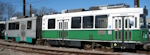
-- Mattapan -- This one can be done with fairly minimal modification and ample recycling of existing structures. Take the small island platform between Tracks 2 & 3 and extend it both directions to 6-car Red Line length, bumper posts at the end of the platform. Drop the trackbed to achieve the proper platform height. Augment the existing shelters but don't get fancy. Wrap the headhouse around to meet the west end of the expanded island for fare control and one west-side exit. Retain the Track 1 island platform shared with the busway as a tertiary platform; extend 100 ft. east to full 6-car length and likewise drop the trackbed. Fence it off from the busway so it's now a side platform inside of fare control. Buff out the sidewalk on the busway side of the fence to compensate for the lost space. Reconfigure the interlockings coming off the Neponset bridge for choosing platforms. For regular ops immediately turning back in revenue service, use the Tracks 2 & 3 island. Use Track 1 primarily for trains that are going out-of-service and either laying over for a longer spell or deadheading back to Codman. Have electronic signage at the station clearly explaining the platform assignments. If Track 1 isn't scheduled for any turning revenue trains for a long period of time have short swing gates that station staff can open or close to block access. Tear down the trolley yard and maint shed. Total cost: $15-25M if they're disciplined and recycle the existing station building and Track 1/busway platform structures effectively.

Whole project can reasonably can be done for a $250M total price tag if managed shrewdly. Something's very wrong and needs audit + further contracting reform if it ends up topping $300M. Codman remains the yard-of-record, so unless you want a 4th non-platform storage track on the south end for misc. storage there's probably no need to have any more end-of-line track capacity than Orange's seldom-used Oak Grove tail track an equal number of stops from Wellington as Mattapan is from Codman (at lighter Ashmont Branch headways for slipping in deadheads). Trolley viaduct at Ashmont would get torn down or be partially dismantled/partially recycled for a side path on the east side of the Codman embankment linking the former Cedar Grove station entrance direct into Ashmont. Expanded Neponset trail system (to be completed west of Central Ave.) brings Butler, Valley, Capen direct into Milton or Mattapan station catchments. Abandoned trolley yard at Mattapan becomes a possible TOD opportunity to underwrite that station's capital costs with private development.


Ta-da? If Milton were willing to part with its boutique intermediate stops full Red conversion project-managed well is pretty low-hanging fruit, no?
  • 1
  • 3
  • 4
  • 5
  • 6
  • 7
  • 16