Railroad Forums 

  • Ashmont-Mattapan Trolley Line Discussion

  • Discussion relating to commuter rail, light rail, and subway operations of the MBTA.
Discussion relating to commuter rail, light rail, and subway operations of the MBTA.

Moderators: sery2831, CRail

 #1422136  by The EGE
 
That's 4,600 unlinked trips (single rides) - representing about 2,300 round trip riders. Assuming they use passes, you'd only be getting the revenue from 2,300 passes, not 4,600.
 #1422366  by bgl
 
I always found the ridership numbers to be suspect - at least 50% of daily my rush hour trips home from Ashmont has the guy not collecting fairs/taps, and the 50% of the time he does, half the people board from the rear door anyway. And we are talking about the trolley being jam packed any time during rush hour.
 #1422389  by CRail
 
Ridership numbers come from tabulators (people counting passengers boarding and alighting), not from the farebox. They might be watching multiple trips at a single stop or riding a vehicle watching every stop. A tabulator's data sample is assumed to be typical and totals are generated based on that. It's surprising what can be concluded from this method.

The revenue bean counting serves as evidence that folks are failing to grasp the function of the line specifically and the Authority in its entirety. Naturally, increasing the farebox recovery ratio is beneficial, but it is not the first nor the second (nor third for that matter) priority of those designing and implementing the service. The high speed line does not operate to turn a profit, nor could it, nor should it. It serves as the only mode of travel into the metropolis which is deemed acceptable by its ridership, and it keeps ridership numbers up on a busier line that would serve fewer people and thus be less economical should it no longer exist. The agency's priorities are to 1.) move the people 1A.) safely and 1B.) in a timely manner, 2.) collect revenue to help pay for it. When 1 and 2 prove mutually exclusive, #1 takes precedence.
 #1429853  by X No Passengers
 
The MBTA is a transportation agency; there's no room for art, aesthetics or feelings when it means that money is being wasted or these trains are operating at the expense of better service for the thousands of residents in the area. Treating these streetcars as if they are organic, having a connection to this city other than aesthetics, is absurd.

Paving over the existing right-of-way is a quick, short-sighted fix to a complicated, long-term problem; namely the issue of how to reconcile this town's history and culture with the lethargic pace of modernization. All of the people who support the continuation of the PCCs knows that eventually, we will have to part ways with them. The argument it would seem then, is over when we cut the cord.

Would these advocacy groups that want to save the trolleys be open to a new fleet of cars that shares the same basic design, but have all the modern hardware to allow for greater service capacity in the Mattapan corridor? Ultimately, the MBTA will choose to move on to modern rolling stock when the cost of maintenance exceeds the cost of acquiring new trolleys. Who knows who long that could be given the rate at which their mechanics are working magic to keep these things in operation. The most viable solution, and the one that creates the least inconvenience for the smallest number of people, is to immediately look for alternatives. The MBTA can't afford another 5 years of kicking the can down the road when only a handful of ancient trolleys stand between them and a federal lawsuit.
 #1429857  by The EGE
 
I suspect that the reason for kicking the can this time was to buy time until a Type 10 purchase has been finalized. At that point, it would be clear whether the 20 1997-built Type 9s, or the 24 2018-built Type 9s, will be available to be relocated to the Mattapan Line.
 #1429885  by Leo Sullivan
 
I think you should all remember that El Paso is building a line which will use re-equipped PCCs and, San Diego has received some for downtown operation.
There are many PCCs operating in San Francisco, mostly second hand in the last few years. A main route in Philadelphia was recently re-opened using
modernized PCCs. PCCs when properly maintained are less expensive in all ways
than any other post war light rail car available in the US. Solid state re-equipment is possible and popular in the cities mentioned above.
New PCC derived, four axle cars are available from Pragomex in the Czech Republic. All of the above are or can be handicapped accessible.
The cost of maintaining PCCs is governed by parts availability. Skoda who equipped the present MBTA trolleybuses makes the heavy PCC hardware
and is one of the makers of solid state conversion packages.
LS
 #1429926  by F-line to Dudley via Park
 
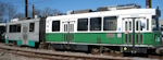
The EGE wrote:I suspect that the reason for kicking the can this time was to buy time until a Type 10 purchase has been finalized. At that point, it would be clear whether the 20 1997-built Type 9s, or the 24 2018-built Type 9s, will be available to be relocated to the Mattapan Line.
...or finally convert it into a proper Milton-Mattapan Red Line extension.

Part of the pearl-clutching about trolleys is that Milton has always jealously guarded its boutique intermediate stops and shut down any talk of a stop-consolidating heavy rail conversion. That genie isn't going to stay in the bottle forever the way demographics and traffic demands in the outermost neighborhoods are changing. The ridership served, transfers served, and cars taken off the roads at Lower Mills and Mattapan with an Ashmont Branch one-seat at Ashmont Branch headways outslugs the trolley by orders of magnitude. And Blue Hill Ave. CR station + BRT-ification of the 28 isn't going to be enough to triage the Mattapan corridor's connectivity to downtown. It's enough of a burning issue below the surface that the not-too-bad cost and schedule of an HRT conversion (2 grade separations, 2 prepayment station rebuilds, power upgrades, outbound-facing Codman Yard turnouts, and not much else of significant steel-and-concrete proportions) aren't going to stifle the debate. Cedar Grove, Butler, Valley Rd., and Capen aren't going to make an 'intangibles' case for another round of status quo when 21st century trending has grown that outsized.

So this is probably going to be the last "kick-the-can" stopgap they can make after nearly a century of periodic punts on that issue. This is the last time going to the well on 'historic' cred with the rolling stock. The BRT-everywhere trojan horse got defeated so soundly last time that it's never popping back up. The 28X BRT proposal out of Dudley went down in flames, and while it's still badly needed for many other reasons it shouldn't have been overhyped as much as it was as all things to all people. Blue Hill Ave. CR will help, but station location doesn't tap all the bus transfers of Mattapan Sq. hub at frequencies quite high enough to move the needle on Yellow Line service levels. And the successful TOD redev of Lower Mills has exploded street traffic levels enough to affect OTP of the Ashmont Hub buses through there more hours of the day, heightening the need to move the two (instead of three) -seat transfer further out.

Whether the final decision in another 10 years defaults to modern LRV's or not, there's probably going to be a more thorough and out-in-the-open debate about the proper Red Line than we've ever seen hashed out before. Formal study at minimum...not being cut off at the pass by Milton covering its ears and shouting "No! No! No!" about its boutique stops. If the decision is made to stay with trolleys permanently, it'll be with a package of enhancements that allow the trolleys to specifically target the growth...not simply another stopgap punt. And that'll be a healthy exercise whichever way it leans, if for no other reason than quantifying modern numbers for each alternative and getting a full public airing of the options.


As for the future of PCC's in Massachusetts...how about Lowell??? The Canal district, visions for growing it as an employment center, and tie-ins to the CR station have many similarities with the Kenosha, WI streetcar. Only here there's something pre-existing to build off of if they want to take their 38-year-old museum streetcar and run the football turning it into general-purpose transit. The city's long wanted to expand the streetcar further around the canal district, tie it into more UMass space being built around the canals, and bring its terminus down the street into the CR station busway. But they've always shied away from a full-on commitment, with the last city referendum a year-plus ago similarly taking a punt.

Eventually they're going to work up the courage to exploit that asset and extend the route mileage to loop and spur further around. Though whether they put enough oomph in it to make it real public transit or just a stretched-thinner museum piece is a 'vision thing' they've still got to work out as they learn how to be a growth city. Availability of 10 remanufactured air-conditioned PCC's available in 10 years to run in light duty around the canal as a main fleet sprinkled in with some of the other Seashore touristy cars sounds like a very compelling opportunity to jump-start themselves around. If they can make a decision to go big-time with their network, Kenosha-style.
 #1430000  by rhodiecub2
 
...or finally convert it into a proper Milton-Mattapan Red Line extension.
That would be a great idea if that could happen. If there were a heavy conversion, I could see Butler St and Cedar Grove get conslidated togehter, then Milton & Central Ave, Valley Road consolidate with Capen St.
 #1430013  by F-line to Dudley via Park
 
It would probably only be 1 intermediate stop at Milton because of construction factor. Wouldn't be able to center it at Central Ave. because of the need to take the current downgrade on the incline and build it up to a new rail bridge eliminating the crossing, and the limited room slotting next to the abutting buildings on Central preventing an elevated station there as the bridge needs to stay in a 2-track footprint. Easiest to just use the current Adams St. overpass of Milton Station as place to plunk a headhouse, then start a 300 ft. center platform running on the straightaway west of the overhang where a little retaining wall work on Elm can carve out the room. Would also allow for a second west-end headhouse dumping up onto Elm and to the side on the Neponset Trail right next to the Lower Mills spur walkway across the river...holding down access to the Central Ave. side to ~800 paces from the current Central platform. Buses 27, 240, and BAT #12 can loop down Eliot to the Adams St. side for consolidation at a busway turnout.

Stop spacing would be evenly-matched there: 1.2 mi. Ashmont-Milton, 1.2 mi. Milton-Mattapan. But trying to shiv another intermediate to the east wouldn't work that well because you'd either be barely 2000 ft. from the Ashmont entrance or 1500 ft. from the Milton entrance trying to site a station at either publicly accessible tip of the cemetery. With zero buses to be had, the cemetery obviously creating a density cavity, and the access served up by the Neponset Trail already taking a small chunk out of Butler's utilization in favor of nearby Milton and its buses. Those bus transfers are going to be disproportionately more important with HRT-ification, because what's now a three-seat transfer to downtown at Lower Mills becomes a much simplified two-seater. Cedar Grove + Butler currently do 30% the daily boardings of Milton + Central Ave. But throw the amplification of bus network effects into the mix and that's probably going to be more like a 60%+ disparity, with the combo stop near the cemetery being the Red Line's far-and-away low outlier in ridership because it would be the only stop other than downtown/mainline-situated Charles/MGH with zero bus routes whatsoever.


I think you can cover all catchment needs this way:
-- Butler's already close enough to Milton, so that catchment migrates down the Neponset trail right down the street. Probably nothing whatsoever you need to do to accommodate them except install some lights on that (already very busy) section of path. As above, Central Ave. is well-accommodated down the block by the west-end headhouse dumping onto the trail.


-- Ashmont station currently has no direct ped access to busy Gallivan Blvd., which does isolate it a little from Cedar Grove. However, the trolley incline and viaduct are going to be completely abandoned in an HRT conversion, serving up the room for a grade-separated path to Gallivan where there currently is no space. New path space is guaranteed everywhere north of start of the trolley incline @ Weyanoke St. Depending on how you do the track configuration, Red will shift onto the High Speed Line alignment either:

A) At Weyanoke, but before the Gallivan overpass...with extra yard leads filling up all track berths. Providing a path exit to Wessex St. @ Weyanoke.
B) After the Gallivan overpass in yard limits, somewhere between where the Red-M connecting track and the southerly Codman property line. Providing path exits at Gallivan AND Cedar Grove, by narrowing the path at the Codman property lines for its last 150 ft. to a Milton St. exit.

Any which way it's full grade separation providing first-time ped access to busy Gallivan, expanding Ashmont's southern ridership catchment generously. Shooting for a side path all the way to CG puts that stop's former platform a 1600 ft. lit, grade-separated walk to Ashmont. That's same distance as the midpoint between Ashmont & Shawmut to headhouses of either station...but with added bonus of the much faster grade separation and path utilization from being able to overpass 4-lane Gallivan. I'd almost call that a net gain since for CG because today the lack of access and daunting crossing of Gallivan forces you to double-transfer trolley to bus to catch an Ashmont bus that is in easy crow-flies walking distance. Side path's a big multimodal missing link, but there isn't enough space to shiv it in there today alongside 5 tracks belonging to 2 separate lines.


-- No need for an intermediate spanning Milton and Mattapan. Capen St.'s only 1200 paces from Mattapan, and Neponset Trail's being extended west now linking Central Ave., Valley Rd. and Mattapan under full grade separation. That's plenty good enough east & west accessibility for two stops that combined only draw 102 flies per day. Valley may even see a slight decline in future Blue Books now that Central Ave. and the buses are linked by 2000 ft. paved walk.
Last edited by CRail on Tue May 02, 2017 7:53 pm, edited 1 time in total. Reason: Post within a post within a post removed. This is avoided by using the REPLY button!
 #1432565  by F-line to Dudley via Park
 
It's an original SEPTA car painted in tribute livery, so Market St. Ry. doesn't have any true Boston cars on its roster.

However, it's neat that the restoration is going to have fully color-accurate livery now. They had to approximate BERy's blend of "traction orange" the first time around with the paint they had available for mix. Now they've got it pinned right down to an exact Pantone color match that's the real deal.
 #1432644  by dieciduej
 
It looks like they got the "traction orange" color correct this time. The first time around is had a reddish tint, someone said it was more like PE's orange color. The car numbers look like the font is correct but the BERy font is wrong. I am not sure what the correct font is.

The major gaff is the lack of wings on the headlight! Just saying.

JoeD
  • 1
  • 6
  • 7
  • 8
  • 9
  • 10
  • 16