Railroad Forums 

  • Aerial Photos of the LIRR in the 1960s-1970s

  • Discussion of the past and present operations of the Long Island Rail Road.
Discussion of the past and present operations of the Long Island Rail Road.

Moderator: Liquidcamphor

 #1475492  by nyandw
 
By way of background: After WW II my Dad, Fred A. Lindauer from Patchogue, started Island Air Photo in the early mid 1950's. Hanging out of the door of a single engine Piper Cub, photos were taken of sites clients contracted for: land developers, realtors, corporations, Government organizations, etc. Jim Mooney was in the same business and the subject of this post. Dad went on to accident investigation, c.1956, or so, and Mr. Mooney continued with aerial photography for the next 20+ years as Eagle Eye Air Photo: (See below). Both Dad and Jim knew each other as mutual folks in the business.

Sidebar: Dad was leaning out the door and dropped his expensive Parker pen during one aerial shoot. He wrote to Parker Pen and explained the story and they sent a replacement! A different era for sure.

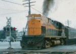
1. I recently received this photo of Lindenhurst View W over School Street c.1970 It sure looks like Jim Mooney's work, but do others have similar photos, information, photos, or recollections on this?
2. My understanding is that Jim was injured severely from a helicopter fall? Perhaps anyone can point the way?

Here's some of Mooney's work: Patchogue aerial photo 1962 Jim Mooney "Eagle Eye Air Photo"
Patchogue aerial photo 9/28/1963 Jim Mooney "Eagle Eye Air Photo"

Note: The older depot was razed as of 5/16/1963. This depot was torn down before the new depot was built as the newer depot was constructed on nearly the same spot as the old depot, unlike other LIRR locations where the old building remained in service while the new depot was built and opened on 7/30/1963.

So we have a Before/After aerial views from Eagle Eye Air Photo on the Patchogue raze and new station location. :-)
 #1475495  by MACTRAXX
 
Steve: Excellent aerial photographs - I love this stuff!!!

I am going to disagree with the 1970 date of the Lindenhurst overview looking westward -
The airview shows a mostly completed elevated structure - which opened in August 1973.
Late 1972 or early-mid 1973 would make more sense from what this picture shows.
http://en.wikipedia.org/wiki/Lindenhurst_station" onclick="window.open(this.href);return false;

The Wikipedia page shows that the temporary tracks went into service in October 1968 and
were used until the Lindenhurst elevated station opened in August 1973.

If you can post more 60s-70s airviews of the LIRR please do...MACTRAXX
 #1475501  by MattAmity90
 
I would fall head over heels if someone took aerial photos of Copiague and Amityville during the grade crossing elimination at the same time the Lindenhurst photo was taken, that way I could get a look at not just the temporary stations, the span being erected, but also the surroundings of the stations. Example would be to see the tracks transition from temporary to main, and to compare it with today's look.
 #1475512  by milepost39
 
Regarding the top photo, that must have been some project to watch going up. Considering all the trouble today to add a third track on LIRR property, I couldn't see anything like that being approved today. A few hundred people would complain about their village being turned into "Queens with a subway L", and thousands would stew in traffic at the grade crossings. As much as I hate AC, I say build the cross sound tunnel its time.

So they build the elevated to the south of the existing tracks? Was there generally enough room or did some business have to be demolished? Pretty neat how once the old tracks were torn up, a new thoroughfare was created.
 #1475513  by MattAmity90
 
milepost39 wrote:Regarding the top photo, that must have been some project to watch going up. Considering all the trouble today to add a third track on LIRR property, I couldn't see anything like that being approved today. A few hundred people would complain about their village being turned into "Queens with a subway L", and thousands would stew in traffic at the grade crossings. As much as I hate AC, I say build the cross sound tunnel its time.

So they build the elevated to the south of the existing tracks? Was there generally enough room or did some business have to be demolished? Pretty neat how once the old tracks were torn up, a new thoroughfare was created.
The Babylon Branch project was easily approved and most importantly received approval from all the towns along the branch. All the towns had Sunrise Highway (Route 27) within a football field of their stations with intersections galore. Towns such as Massapequa Park, Bellmore, and Merrick until 1980 experienced numerous grade crossing accidents, and before 1968 towns such as Wantagh, Freeport, and every station West of Freeport with its high traffic volume was turned into a gridlock. There was a benefit though, because most of the Babylon Branch (with the exception of Massapequa Park) that paralleled Sunrise had ample room to lay down temporary facilities. All they had to acquire were parking lots, areas that were the football length that separated the tracks from the highway, and lucky for them there were no businesses in the path of the temporary ROWs. Massapequa Park was the last to be elevated because the town was complaining that they didn't want a Great Wall of China, but since Unqua Road was the most hazardous along with Park Boulevard, the MTA and the town came to a compromise and from December 18th, 1977 to December 13th, 1980 the station was grade-separated, and officially made Babylon the branch that was fully grade-separated with not a single grade crossing!

As far as the ACL segment that I labeled it (Amityville-Copiague-Lindenhurst), all they had to do was close a street in Lindenhurst (North Hoffmann, which doesn't see a lot of traffic unlike to the South), parking lots in Copiague, and property owned by the MTA LIRR in Amityville. There were buildings close in proximity in Amityville, but since the station was the sight of several freight sidings, they had to make sure that there was space in between the tracks and buildings, therefore making it ideal yet tight quarters. Babylon and every station in Nassau County had their temporary facilities laid to the South of the ROW, while the ACL segment saw theirs laid to the North.
 #1475562  by nyandw
 
MACTRAXX wrote:Steve: Excellent aerial photographs - I love this stuff!!!

I am going to disagree with the 1970 date of the Lindenhurst overview looking westward -
The airview shows a mostly completed elevated structure - which opened in August 1973.
Late 1972 or early-mid 1973 would make more sense from what this picture shows.
http://en.wikipedia.org/wiki/Lindenhurst_station" onclick="window.open(this.href);return false;

Thank you. :-)
If you can post more 60s-70s airviews of the LIRR please do...MACTRAXX
Wish I had more! Steve
 #1476542  by MattAmity90
 
Yeah, I saw the caption on the photo on the website as Spring 1973. If you zoom in, that white space in the upper right corner is Copiague's new elevated platform. Let me know where I can find more aerial photos, because an aerial photo of Amityville being elevated would be sought after because of the construction of elevated viaduct, elevated platform, the temporary station, the new AMITYVILLE Interlocking under construction, and the temporary tracks rejoining the main tracks near Sunrise Highway's bridge.
 #1476548  by nyandw
 
MattAmity90 wrote:Yeah, I saw the caption on the photo on the website as Spring 1973. If you zoom in, that white space in the upper right corner is Copiague's new elevated platform. Let me know where I can find more aerial photos, because an aerial photo of Amityville being elevated would be sought after because of the construction of elevated viaduct, elevated platform, the temporary station, the new AMITYVILLE Interlocking under construction, and the temporary tracks rejoining the main tracks near Sunrise Highway's bridge.
Matt, I concur these are items of historical interest for certain. Having said that, I come across them by chance. eBay is a place I have auto searches on, for example. Folks contact me, and become contributors of material. I believe (disclaimer) that Jim Mooney's Eagle Eye Air Photo's of the LIRR may have be under contracts.

Contact the PR Dep't at LIRR (Duh)
Prowl the net for Eagle Eye Air Photo material. (I just haven't gotten to it)
See if the local libraries/Universities have any of this material. Anyway, you'll know the drill.

Note: My understanding was that Jim had fallen from a hovering helicopter and this ended his photo career. Not verified.
 #1476570  by RGlueck
 
Republic, Fairchild, and Grumman, probably took a ton of aerial shots from the 40's into the era of the moon landings. If these companies are still maintained on the Island, they probably have them in long lost files. If not, check the LI Aviation Museum or Nassau County. I had an old rolled up aerial photo of the LIRR from Jamaica to New Hyde Park, photo backed on canvas, which I passed to the late Carl Waswo, in 1973. Showed a Camelback switching at Holban Yard, too.
 #1476594  by quad50cal
 
RGlueck wrote:Republic, Fairchild, and Grumman, probably took a ton of aerial shots from the 40's into the era of the moon landings. If these companies are still maintained on the Island, they probably have them in long lost files.
Fairchild-Republic destroyed their combined corporate archives. The few surviving artifacts from their archives (such as a contract for P-47s) , were smuggled out shortly prior.
 #1476693  by LB
 
The New York State Department of Transportation was responsible for all Grade Crossing Elimination projects. They have all the plans, drawings, site surveys, contractor information as well as before, during and after photographs. They must have an archives department to allow them to study and leverage past projects to facilitate new projects, as well as maintain/repair current structures. If these are accessible to the general public, it could vastly assist you with your research.
 #1476713  by MattAmity90
 
LB wrote:The New York State Department of Transportation was responsible for all Grade Crossing Elimination projects. They have all the plans, drawings, site surveys, contractor information as well as before, during and after photographs. They must have an archives department to allow them to study and leverage past projects to facilitate new projects, as well as maintain/repair current structures. If these are accessible to the general public, it could vastly assist you with your research.
Is there any way to reach NYDOT?